Laser mapping uncovers dozens of ancient Mayan cities | CNN
Thank You!
Your effort and contribution in providing this feedback is much
appreciated.
Close
Ad Feedback
Laser mapping uncovers dozens of ancient Mayan cities
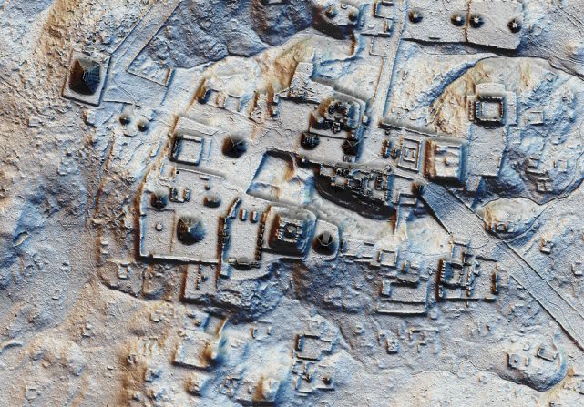
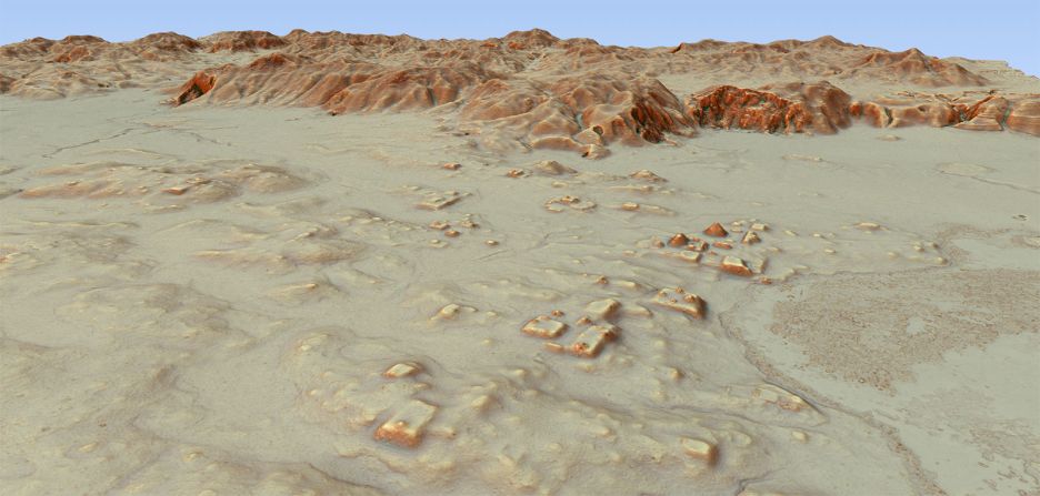
Advanced laser techniques have revealed more than 60,000 ancient Mayan structures beneath the jungles of northern Guatemala.
PACUNAM/Canuto & Auld-Thomas
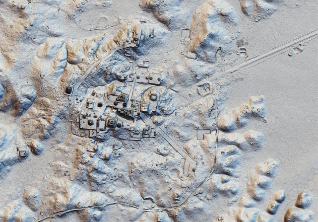
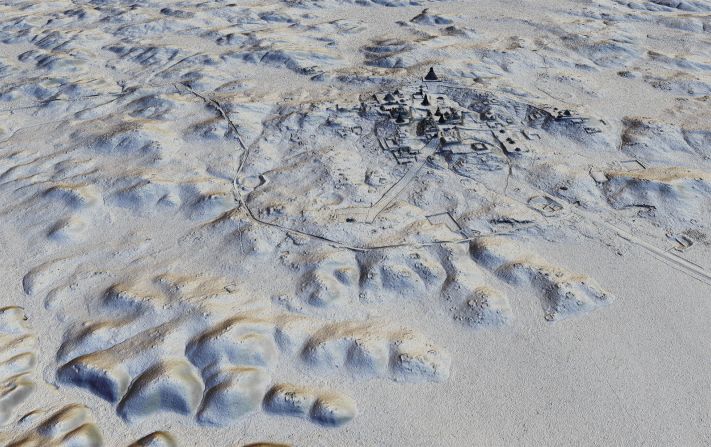
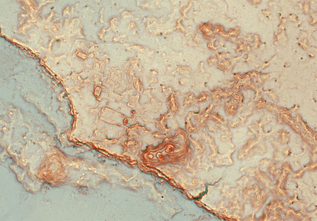
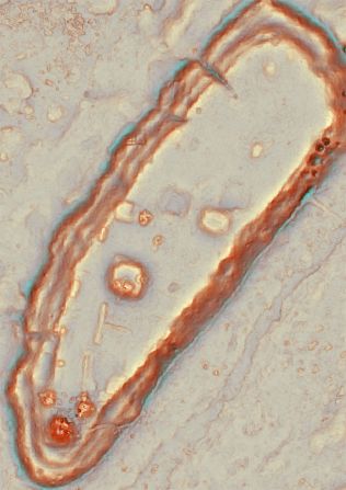
Evidence of agriculture, irrigation, quarries and defensive fortifications were more widespread than experts had anticipated.
PACUNAM/Estrada-Belli
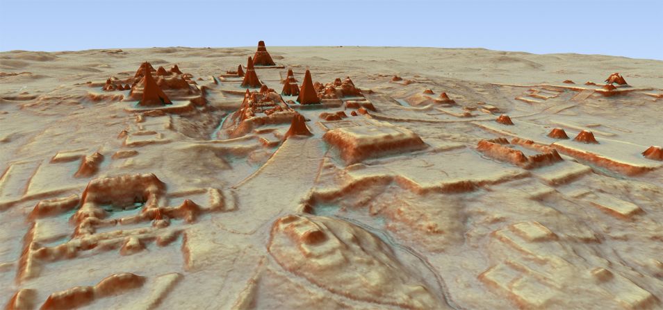
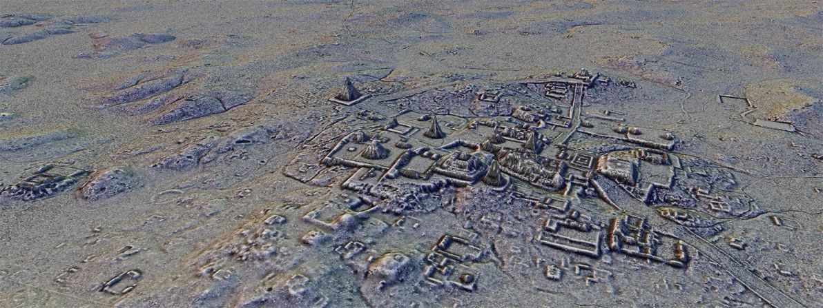
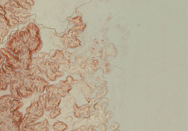
The structures, which include houses, palaces and pyramids, are set across dozens of cities currently hidden by jungle.
PACUNAM/Canuto & Auld-Thomas
The findings suggest that Mayan metropolises were far larger and more complex than previously thought.
PACUNAM/Canuto & Auld-Thomas
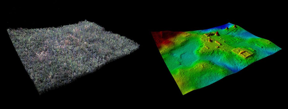
The images were made possible using airplanes with special lasers that can "see" through dense vegetation.
PACUNAM/Garrison
An extensive road network also points to previously unknown levels of interconnectivity between Mayan settlements.
PACUNAM/Estrada-Belli
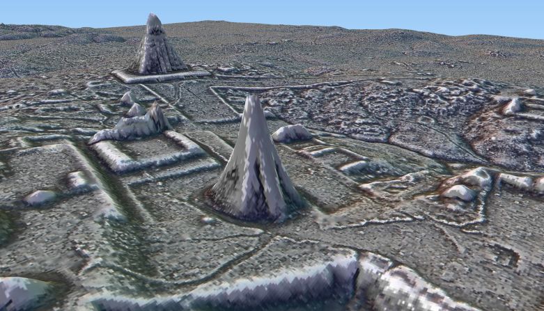
A number of undiscovered pyramids — including one previously believed to be a hill — have been revealed in the aerial maps.
Credits: PACUNAM/Estrada-Belli
Central America's thick jungle has often made large-scale surveys of historical sites logistically difficult. But recent developments in a technique known as light detection and ranging (or "LIDAR") are allowing archeologists to see through even dense forest.
PACUNAM/Canuto & Auld-Thomas
The aerial mapping is carried out by attaching a LIDAR sensor to the underside of an airplane. The instrument scans the landscape by emitting pulses of laser light and measuring the time it takes for them to return.
PACUNAM/Canuto & Auld-Thomas
The resulting data reveals ground-level contours, pointing researchers toward manmade structures beneath the canopy.
PACUNAM/Canuto & Auld-Thomas
The digital maps will later be used to carry out targeted ground research.