
Thunderstorms are bubbling up across the South, opening the door for significant flooding, damaging winds, hail and possible tornadoes to pound the region through Saturday.
Flood alerts are in effect for nearly 15 million people in the South, including parts of Atlanta, through much of Saturday as storms focus in on the region.
Here’s how the threats will play out the next two days:
Friday: Severe thunderstorm and flooding threats expand
A widespread threat for severe thunderstorms and significant flooding is unfolding from the southern Plains to the Southeast as the same storm that delivered drenching thunderstorms and hail to parts of Texas and Oklahoma on Thursday strengthens and tracks east.
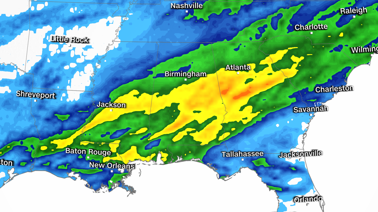
Thunderstorms were pounding an area from far eastern Texas to Alabama Friday afternoon, prompting both flash flood and severe thunderstorm warnings.
A tornado watch was issued Friday afternoon for southern Louisiana, southern Mississippi and southwestern Alabama, according to the Storm Prediction Center. The watch, which lasts until 9 p.m. local time, includes Hattiesburg, Mississippi; Mobile, Alabama; and New Orleans.
“Scattered thunderstorms are forecast to gradually develop and intensify across the watch area this afternoon into the evening,” the Storm Prediction Center said. “The stronger storms will potentially be capable of large hail, damaging gusts, and a tornado risk with the more intensely rotating thunderstorms.”
In addition to the severe storms, a continuing flood threat is expected to persist across the Deep South Friday afternoon and night. Numerous flash flood warnings are in effect in Mississippi, including the Jackson area, where 3 to 5 inches of rain had fallen by Friday afternoon.
Flash flood warnings stretched over nearly 150 miles of Mississippi Friday afternoon as training storms – storms that move over the same area in quick succession – dumped 2 to 3 inches of rain in just a few hours.
Thunderstorms will continue to develop through the evening hours, becoming more dangerous as they slowly track east over the Lower Mississippi Valley and into the Southeast.
Hail, damaging wind gusts, torrential rain and tornadoes are all possible through the evening. A tornado risk covers a large area from Texas through Alabama and into part of Florida.
Shreveport, Louisiana; Jackson, Mississippi; and Mobile, Alabama, are just a few of the cities under a Level 2 of 5 risk of severe thunderstorms on Friday, according to the Storm Prediction Center.
A Level 3 of 4 risk for flooding rainfall is in place for parts of Mississippi, Alabama and Georgia, including parts of the Atlanta metro. Atlanta already dealt with significant flooding Wednesday after 3 inches of rain inundated the area.
Torrential rainfall from late Friday through the overnight hours could bring an additional 3 to 4 inches to the Atlanta area and create a fresh round of dangerous flash flooding.
A Level 2 of 4 risk for flooding rainfall is in place from Louisiana into parts of Tennessee and the Carolinas. Widespread rainfall totals of 1 to 2 inches of rain are likely and could trigger flash flooding.
Saturday: Stormy weather eyes the East
The wide-reaching storm will expand to much of the East by Saturday and unload another day of severe thunderstorms and flooding.
The greatest risk of severe thunderstorms will once again center over the southern US. Damaging storms from Friday night are likely to continue Saturday morning in parts of Alabama, Georgia and Florida.
Additional storms may rumble to life and push into the Carolinas as rising temperatures provide an extra boost of energy Saturday afternoon.
Damaging winds, flooding rainfall and a few tornadoes are expected to be the main risks associated with Saturday’s potent thunderstorms.
Farther north, the storm will spread drenching rain over the Great Lakes early and reach the Northeast by Saturday afternoon. Rain may change to a wintry mix of rain, ice and snow for high elevations of the interior Northeast late Saturday.
After days of active weather, the storm is expected to exit much of the East Sunday and allow drier conditions to take hold. However, some rain and wintry mix may persist in New England.

