
As temperatures rise and the world’s oceans store more potential fuel for storms, a new study proposes adapting the scale that measures the intensity of hurricanes to account for stronger storms.
The Saffir-Simpson scale currently goes from Category 1 to 5; the study, published Monday in the Proceedings of the National Academy of Sciences journal, suggests adding a Category 6.
A Category 5 hurricane is a storm that has sustained winds of 157 mph or greater. The new scale would cap Category 5 storms at 192 mph and anything above 192 mph would become a Category 6 hurricane.
The study’s authors – Jim Kossin, a distinguished science advisor at the First Street Foundation, and Michael Wehner, a senior scientist at the Lawrence Berkeley National Laboratory – argue as climate change leads to soaring ocean temperatures, the potential wind intensity of hurricanes – also known as tropical cyclones or typhoons in oceans outside the Atlantic and East Pacific – is increasing.
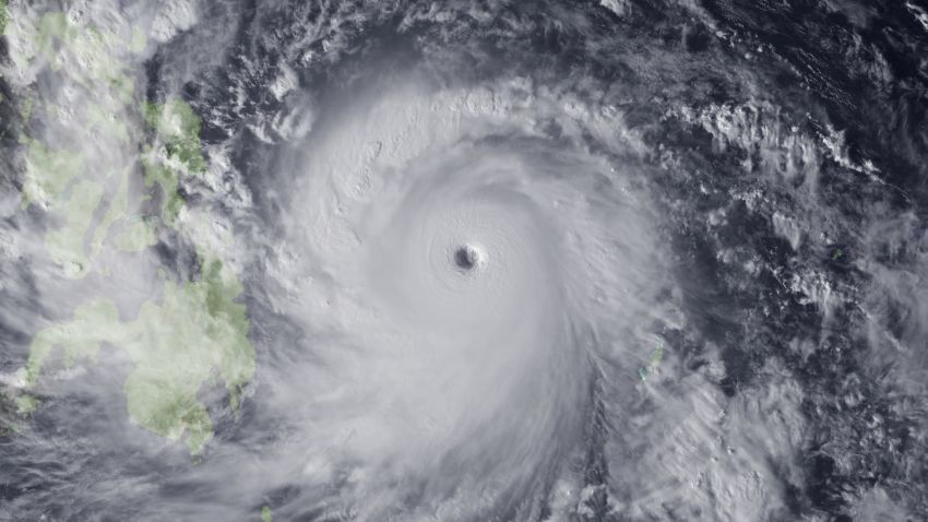
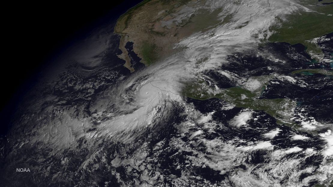
In fact, of the 197 tropical cyclones worldwide that reached Category 5 status between 1980 and 2021, five exceeded the hypothetical Category 6 threshold, the study found. All five occurred since 2013, including 2015’s Hurricane Patricia, which hit Mexico, and Super Typhoon Haiyan, which devastated the Philippines in 2013.
But the idea of adding a Category 6 to the scale is nothing new: It’s been discussed for years.
The Saffir-Simpson scale, which has been around since the early 1970s, also has limitations in that it is only a wind scale and does not include the impacts of storm surge and rain-induced flooding, which can be the most deadly and damage-causing aspects of landfalling storms.
As the planet warms, these impacts of hurricanes are becoming more dangerous. Sea level rise of only a couple of inches can make a dramatic difference in how far inland storm surge can travel, and a warmer climate also means there will be more water vapor available in the atmosphere to potentially fall as rain.

