


Winter is about to kick into overdrive in the US. A one-two punch of winter storms and the first Arctic cold outbreak of the season are poised to affect millions of Americans through next week.
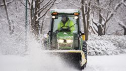
Up first, a winter storm is on track to deal a blow of heavy snow and treacherous ice to the Northeast and mid-Atlantic this weekend.
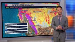
Another bigger and more potent storm will follow hot on its heels through midweek with all hazards: snow, ice, strong winds, tornadoes and flooding rainfall.
“Confidence continues to increase for a highly impactful event spanning from Texas to the Great Lakes and Northeast U.S. through the middle of the week,” the Weather Prediction Center said.
Here’s the latest on these developing storms:
Weekend winter storm
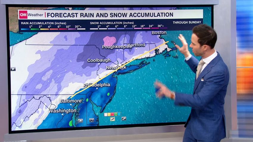
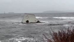
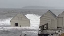
Around 40 million people are under winter storm alerts from the mid-Atlantic to the Appalachians and into southern Maine, with the storm’s worst expected Saturday to Sunday in parts of the Appalachians and the interior Northeast and New England, including just to the west of Boston.
Interactive: Check to see if you’re under a winter weather alert here.
Most of the major cities along the Northeast’s I-95 corridor appear set to miss out on heavy snow, but by the time the storm exits the coast, it could have wrung out as much as 12 inches of snow and as much as 0.25 inches of ice across the eastern US.
On Friday, the storm spat out rain in parts of the South lighter snow to the north in parts of the Plains and Midwest.
The system will continue to track through the Southeast and into the mid-Atlantic Friday into Saturday, delivering heavy rain and even the threat of a few severe storms along the Gulf Coast.
Potentially damaging ice could accumulate in the southern Appalachians Friday night into Saturday morning as the storm starts to work its way into colder air. Travel in these regions could be treacherous, especially in hilly and mountainous terrain, as ice sticks to surfaces.
It appears there won’t be sufficient cold air to churn out much, if any, snow in the snow-starved I-95 corridor. None was forecast in Baltimore, DC or Philadelphia Friday, so their nearly two-year long significant snowless streaks seemed like they would continue.
But other cities, especially in New England, have higher snow chances. Four to 6 inches of snow are forecast in Boston. That may not live up to Boston’s notorious snowstorm past, but it could still be the city’s biggest snow from a single storm since February 25, 2022 when 8 inches fell.
And if the 8 inches forecast in Hartford, Connecticut, comes to pass it would be the city’s biggest snowstorm since February 1, 2021, when 11 inches fell.
Further south, areas of the Appalachians could see up to two inches of snowfall and ice accumulations as thick as 0.25 inches. Winter storm watches and warnings are in effect from western North Carolina to western Virginia beginning Friday evening and lasting through Saturday afternoon.
Powerful, sprawling storm next week
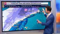
The second storm will begin to strengthen rapidly Monday as it cuts through the Central US toward the Great Lakes, delivering snow and potential blizzard conditions to colder areas to its north along its path.
Exactly where and how much snow falls will likely change with the storm’s track, which is still uncertain, but the highest chances for heavy snow are in parts of the Plains, the Great Lakes and interior Northeast.
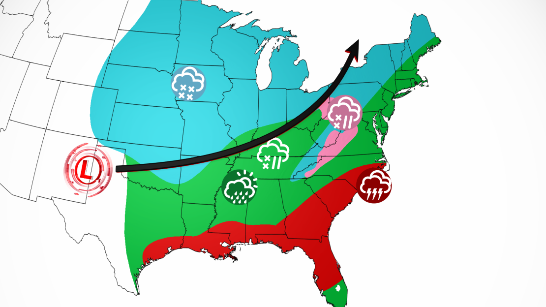
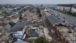
The storm will be tapping into warmer, moist air from the Gulf of Mexico to its south, raising the risk of severe storms, including a few strong tornadoes and damaging winds, and flooding rainfall near the Gulf Coast.
A Level 2 of 5 risk for severe storms is already in place for Monday and Tuesday, stretching from southeast Texas to the Carolinas.
A Level 2 of 4 risk for flooding rainfall hugs the coasts of Louisiana to the Florida Panhandle for the storms that will cross the area Monday.
As the storm moves northeast, rain and strong wind gusts will spread over much of the eastern half of the US. A Level 2 of 4 risk for flooding stretches from northeast Georgia to southern Massachusetts, and a Level 3 of 4 is in place just outside of the New York City metro in eastern Pennsylvania, northern New Jersey and southeast New York, where up to 4 inches of rain could fall.
Many of these areas will have just been doused and snowed on by the first storm.
Heavy rain on its own could cause flooding, but rain on top of snow amplifies the risk, as warmer rain melts the snow and injects its water quickly into watersheds. In December, a potent storm caused deadly and destructive flooding in parts of interior New England after its heavy rain melted snow.
As the second storm departs by end of week, an “Arctic air outbreak” looks likely to descend on much of the US, according to the Climate Prediction Center.
While it’s too soon to know exactly how cold it will get, forecasts are calling for below-average temperatures through mid-January for every area save the East Coast.
And with colder air in place, there could be even more snow in the forecast in the weeks to come.
CNN’s Robert Shackelford contributed to this report.

