
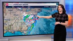


A winter storm is plowing through the mid-Atlantic and Northeast Saturday, and there’s another stronger one nipping at its heels that will affect a much wider area of the US.
The first storm will unleash up to a foot of snow through Sunday that could cause travel disruptions for the millions currently under winter storm alerts.
Freezing rain fell throughout early Saturday in the interior mid-Atlantic, including parts of Virginia and North Carolina where enough ice accumulated to make driving dangerous.
Heavy snow reached the interior Northeast in the late morning Saturday. A couple of inches of snow were already reported in central Pennsylvania by Saturday afternoon, ending the 346 day-long wait in the area for widespread significant snow.
Roads conditions deteriorated across the area as the snow started to accumulate and Pennsylvania Department of Transportation maps showed widespread slow downs on roads.
Pennsylvania transportation crews started prepping roads for these conditions on Friday with the goal to “keep roads passable, not completely free of ice and snow,” a Pennsylvania DOT statement said.
Parts of Pennsylvania will see some of the storm’s worst, along with parts of the Appalachians and the interior Northeast and New England, including just to the west of Boston.

Heavy snow will spread northeast throughout Saturday, with the heaviest finally reaching New England by the late afternoon and continuing overnight into Sunday.
Visibility and road conditions will start to go downhill quickly as snow moves into new areas, with 1 to 2 inch per hour snowfall rates likely.
Governors and other officials in New York, Connecticut and Rhode Island touted their preparations for the storm Saturday before the worst arrived and encouraged people not to venture out.
“We are ready for the storm. We ask you to do the same,” Rhode Island Gov. Dan McKee said at a news conference Saturday. “With advance notice, stay alert and stay home if you can.”
Major disruptions were less likely in the major cities of Philadelphia, Baltimore, New York and Washington, DC, in the snow-starved I-95 corridor. The storm’s track and insufficient cold air combined to limit snow chances to little, if any. Rain, or even a mix of wintry precipitation, is more likely.
But other cities, especially in New England, have higher snow chances. Several inches of snow were forecast in Boston. That may not live up to Boston’s notorious snowstorm past, but it could still be the city’s biggest snow from a single storm since February 25, 2022, when 8 inches fell.
And if forecasts in Hartford, Connecticut, come to pass, the storm would be the city’s biggest snowstorm since February 1, 2021, when 11 inches fell.
Crews in Boston also prepped streets, which were expected to remain open. They put drivers and and up to 800 pieces of equipment on standby should the need arise.
“Our goal will just be to keep on top of the storm as it is happening to keep streets clear and passable,” Boston Chief of Streets Jascha Franklin-Hodge said at a Friday news conference.
“In general though, when there is weather like this, we ask that people use caution if they are going out that they drive carefully.”
An even more powerful and menacing storm
Another bigger and more potent storm will follow the first storm’s through midweek with all hazards: snow, ice, strong winds, tornadoes and flooding rainfall.
It will begin to strengthen rapidly Monday as it cuts through the Central US toward the Great Lakes, delivering snow and potential blizzard conditions to colder areas to its north along its path.
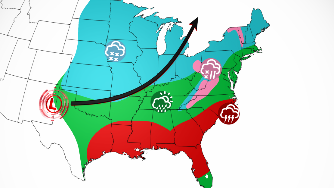
Exactly where and how much snow falls will likely change with the storm’s track, which is still uncertain, but the highest chances for heavy snow are in parts of the Plains, the Great Lakes, Midwest and interior Northeast.
Chicago and Milwaukee could both be in for snow.
The storm will be tapping into warmer, moist air from the Gulf of Mexico to its south, raising the risk of severe storms, including a few strong tornadoes and damaging winds, and flooding rainfall near the Gulf Coast. The severe storm risk will be greatest Monday and Tuesday in southern portions of the Southeast, including Florida.
As the storm moves northeast, rain and strong wind gusts of 40 mph or greater will spread over much of the eastern half of the US. Flooding and power outages will be serious concerns.
Winds could be particularly strong along the East Coast. Meteorologists at the National Weather Service in Boston said Saturday morning that Hurricane Force Wind Watches – warning of winds of 74 mph or greater – may be needed for the area if confidence continues to grow in the chance for such winds.
Widespread heavy rain will fall on top of areas just doused and snowed on by the first storm.
Heavy rain on its own could cause flooding, but rain on top of snow amplifies the risk, as warmer rain melts the snow and injects its water quickly into watersheds.
An area between Philadelphia and New York City, including Trenton, New Jersey, was placed under a Level 3 of 4 risk for flooding on Friday, well in advance of its expected impact on Tuesday by the Weather Prediction Center. This signals rare confidence in a high impact flood event for the area.
This same, destructive story played out in December, when a potent storm caused deadly flooding in parts of interior New England after its heavy rain melted snow.
CNN’s Amy Simonson, Sarah Dewberry, Maria Sole Campinoti, Samantha Beech contributed to this report.

