For those who need chilly weather and snow to get into the holiday spirit, the run-up to Christmas will be disappointing across much of the US. Millions will see unseasonably mild conditions through early next week, and for some Christmas Day will end up warmer than Halloween.
This unusual warmth may be the perfect present for holiday travelers during the week as it will reduce the likelihood of disruptive winter storms. However, some last-minute travelers may not be so lucky this weekend.
The 10-day holiday travel period starting Saturday is likely to be the busiest ever at US airports, according to AAA’s year-end holiday forecast. All told, 115 million Americans are expected to travel at least 50 miles from home this holiday season. Here’s what many of them can expect.
All-clear in East, but travel woes for West
Conditions will be dry and largely calm for travelers across the eastern half of the US through Friday. Some rain will stretch from the southern Plains into the Midwest from Friday into Saturday, but heavy, flooding rainfall is unlikely.
There’s a greater chance for disruptive travel weather in the West this week where at least two storms could cause issues. The first storm will bring wet weather to California Wednesday through Friday. Low elevation rain is possible across a large portion of the state while several inches of snow will fall in the Sierra Nevada.
A flood threat will arise for portions of Southern California – especially coastal areas – as repeated rounds of steady rainfall and a few thunderstorms develop each day through Friday. Stormy weather will push into the Southwest later Friday and impact the region through Saturday.
A second disruptive storm will bring low-elevation rain and high-elevation snow to the Pacific Northwest on Friday and move into the Rockies on Saturday. These two disruptive storms will combine to form a larger storm in the Rockies late Saturday and spread snow from Montana to Arizona and New Mexico through Sunday.
A large swath of rain will stretch from the southern Plains and Lower Mississippi Valley to the Midwest on Sunday as the Christmas Eve storm expands its reach. Along with the steady rainfall, breezy conditions may develop across the central US.
Snowfall may snarl Christmas Eve travel in Denver and Salt Lake City, while rain and a few strong wind gusts could lead to issues from Dallas to Minneapolis.
Records in jeopardy on Christmas
Typically, a large storm in the central US on Christmas Eve would likely mean snow for a much more expansive swath of the region – but this year is different.
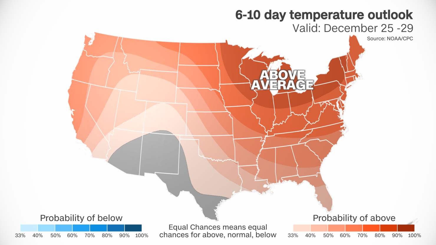
Very mild and potentially record-breaking temperatures are set to develop across the region due in part to the influence of El Niño, a natural ocean and weather pattern in the tropical Pacific that influences weather around the globe.
Temperatures through Christmas will be more than 20 degrees above average in portions of the Midwest and around 10 degrees above average in areas farther south. For many, it’ll feel more like late October or early November, rather than late December.
Daily high temperature records are in jeopardy across the Upper Midwest on Saturday and across more of the Midwest and Plains on Christmas Eve. Record warmth will likely extend to Christmas Day in the Midwest.
The high temperature in Minneapolis is forecast to top out in the upper 40s on Christmas Day. The city typically only reaches the mid-20s in late December, but could come close to its warmest Christmas Day on record this year.

Despite a high temperature of 20 degrees above normal in the forecast, record-breaking warmth is just out of reach for Christmas Day in Chicago. A high in the mid-50s is likely, which is about 15 degrees warmer than the city was on Halloween.
In fact, many major cities from Minneapolis and Chicago to St. Louis are forecast to have a warmer day on Christmas than on Halloween.
With warmth and rain also comes a lackluster amount of snow on the ground, known as snow cover, across the US. Only 15.7% of mainland US had snow on the ground as of Wednesday morning, according to NOAA. Most of this snow cover is in the Rockies, with some in the high terrain of the Northeast.
Snowfall across the Rockies this weekend will likely help raise the overall snow coverage percentage slightly. But it may not be enough to prevent this year from some of the least-expansive Christmas snow cover in two decades.

