

If the images of liquid fire don’t grab you, these staggering numbers from the Kilauea volcano eruption might.
Lava keeps spewing on Hawaii’s Big Island, swallowing homes and igniting fears of more destruction to come from Kilauea.
Here’s what the disaster looks like, by the numbers:
2,140 degrees Fahrenheit
That’s the temperature of Kīlauea lava when it erupts. It’s 1,170 degrees Celsius, and it’s hot enough to melt gold.
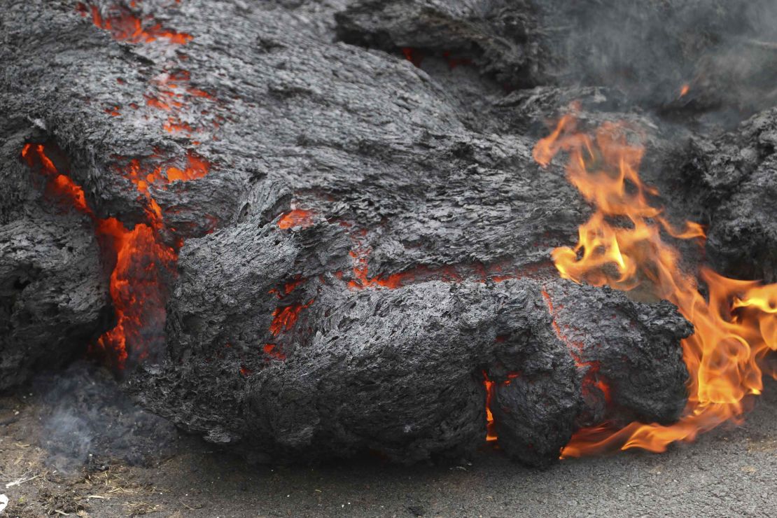
After lava starts seeping across the surface, you can generally tell how hot it is by its color.
Yellow means the lava is about 1,832 to 2,192 F. Orange is about 1,472 to 1,832 F. And red is about 1,112 to 1,472 F.
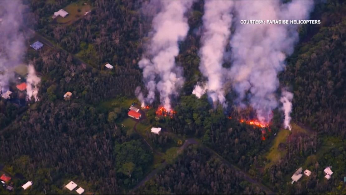
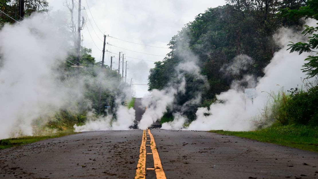
36 structures destroyed
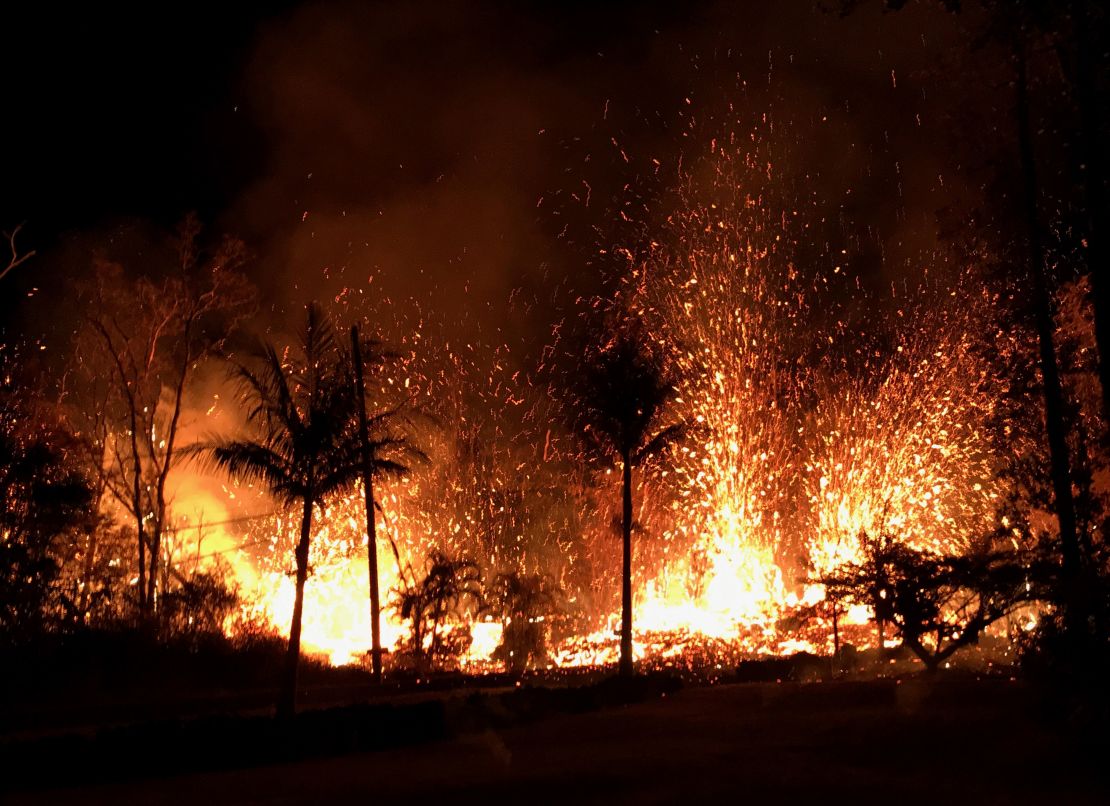
That includes at least 26 homes, and those numbers could grow. “The intermittent eruption of lava in Leilani Estates in the lower East Rift Zone of Kīlauea Volcano continues,” the US Geological Survey said.
1,700-plus residents evacuated
All residents of Leilani Estates and nearby Lanipuna Gardens were told to evacuate. For one man, that meant saying goodbye to a house he built with his own hands.
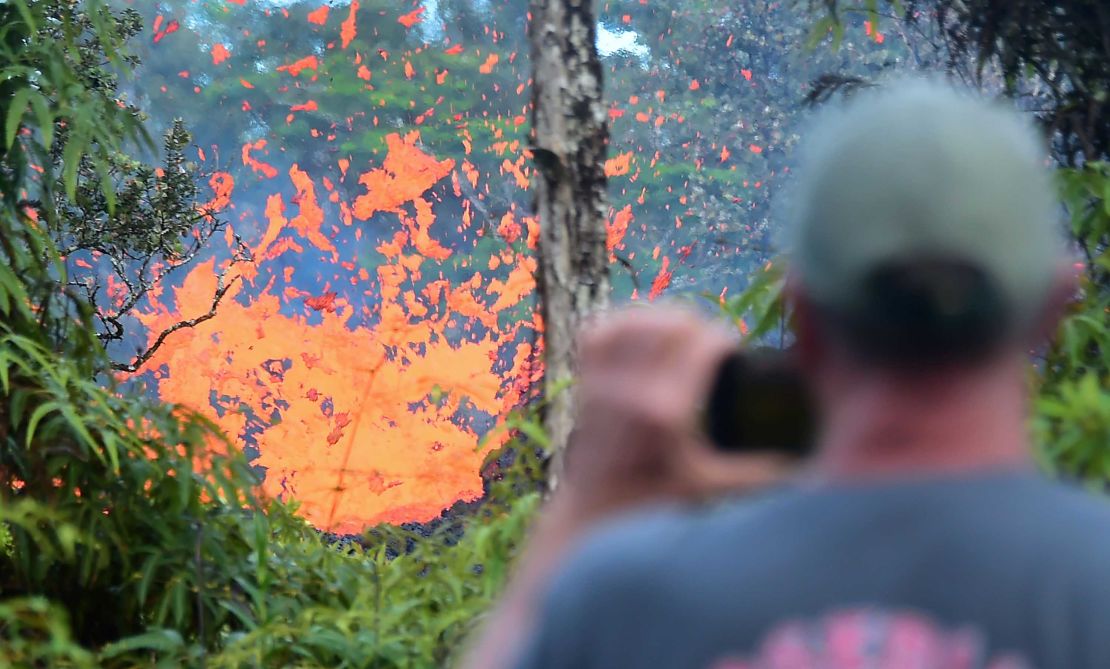
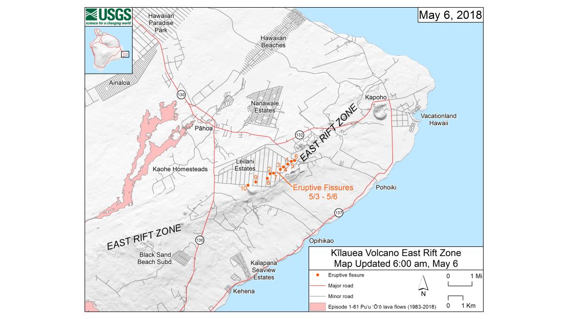
15 fissures
Imagine the ground splitting open, revealing cracks through which lava can pour. That’s what fissures are. And now the Big Island’s Leilani Estates area – miles east of the Kilaeua volcano’s caldera – has at least 14 new fissures, spouting lava and sulfur dioxide, since the eruption May 3.
On Wednesday, a 15th fissure formed – this one in the Lanipuna subdivision, the Hawaii County Civil Defense Agency said.
Hundreds of earthquakes
In the last week, there have been more than 890 earthquakes with a magnitude of 2 or greater on and around the Big Island, according to the USGS Volcano Science Center.
Even before the recent eruption, magma shifting around underground was already causing quakes, CNN meteorologist Judson Jones said.
“The quakes are usually a good indication that an eruption may occur,” Jones said.
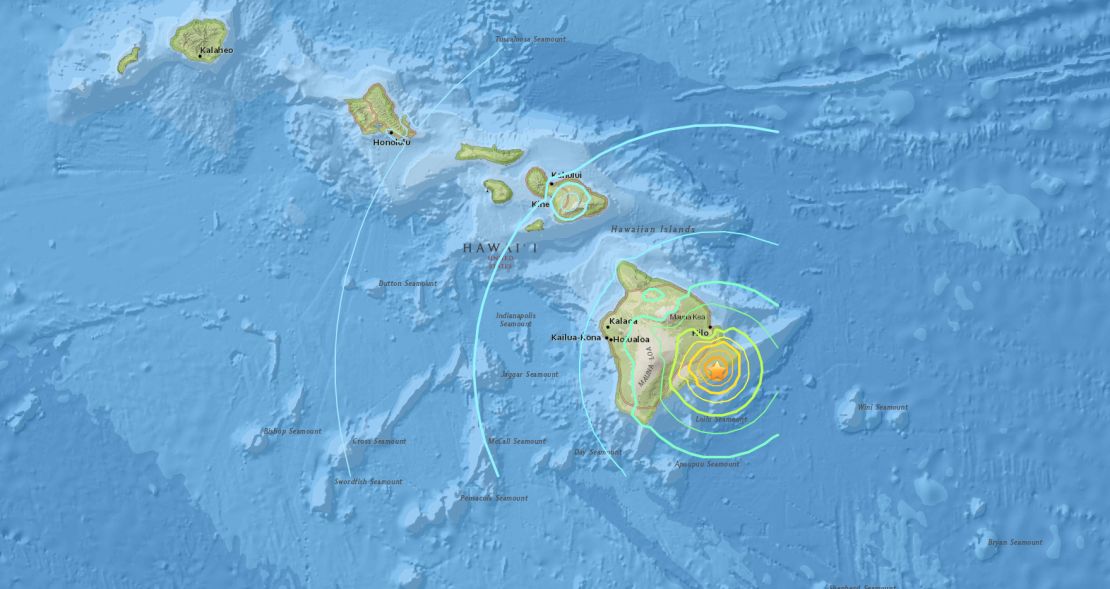
The biggest was a 6.9 temblor Friday.
On an island known for unpredictable quakes and volcanic eruptions, it’s impossible to be sure exactly when the next will strike.
CNN’s Judson Jones, Janet DiGiacomo, Marilia Brocchetto and Jason Hanna contributed to this report.


