As millions gear up to travel for the upcoming holidays, heavy rain, snow, and gusty winds may delay Californians taking to the sky and roadways for the next few days.
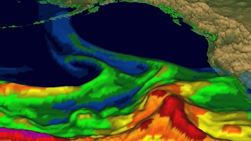
A flood watch is in place for over 20 million people across Southern California, including Los Angeles, as an atmospheric river threatens to bring flooding and mudslides.
Right on the heels of a system that hit California on Tuesday, another system will now move across the Golden State Wednesday through Friday.
“A stronger storm will bring several hours of steady moderate to heavy rain and gusty winds Wednesday and Friday, with threats for flooding and thunderstorms,” the National Weather Service office in Los Angeles said.
Rain has already begun falling in Northern California, and the system will start sliding south through the day Wednesday. By Thursday, this storm will peak in Southern California with a few lingering showers Friday.
The weather service also warns that high-resolution models are “indicating a low but non-zero threat of rotation in the storms that could result in waterspouts or small tornados, especially between Point Conception and coastal LA County.”
Thunderstorms are rare in the state. Coastal California sees roughly five thunderstorm days per year, compared to Florida, which averages 80 days annually.
Widespread rainfall of 2 to 4 inches is expected along the coast with 4 to 8 inches of rain possible in the mountains. Los Angeles could see more than a month’s worth of rain in just a few days.
The greatest threat for flooding Wednesday will be north of Los Angeles where there is a Level 3 out of 4 moderate risk of excessive rainfall along the central coast of California, including Santa Barbara and Oxnard. Thursday that threat shifts slightly south to include Santa Monica and Redondo Beach.
“This magnitude and rate of rainfall is likely to cause scattered/numerous instances of flash flooding, some of which could be significant and higher end with the possibility of flash, urban, and mud/debris flows over recent burn scars,” the Weather Prediction Center said.
The storm will also bring significant snow across portions of the Sierra Nevada, where the highest peaks could see 6 to 12 additional inches.
By Friday, this system will push that moisture farther east into Arizona, Utah and Nevada. Gusty winds of 20-30 mph will also be a factor for those states, leading to hazardous travel conditions heading into the holiday weekend.

