Flood watches stretch along much of the California coast and some evacuation warnings have been ordered as another round of heavy rain rolls into the already soaked state and the threat of floods and landslides grows.
The National Weather Service issued a flood watch set to begin Sunday afternoon for Santa Barbara County, just north of Los Angeles.
Emergency management officials there geared up for the incoming storm as they issued evacuation warnings Saturday for some areas ahead of possible flash flooding, localized flooding and landslides.
The first round of rain began across central California early Saturday evening and doused Santa Barbara County Saturday night. “However, heavy rainfall is forecast to begin the evening of Sunday, February 18, and can continue in bursts through Wednesday, February 21,” according to county officials.
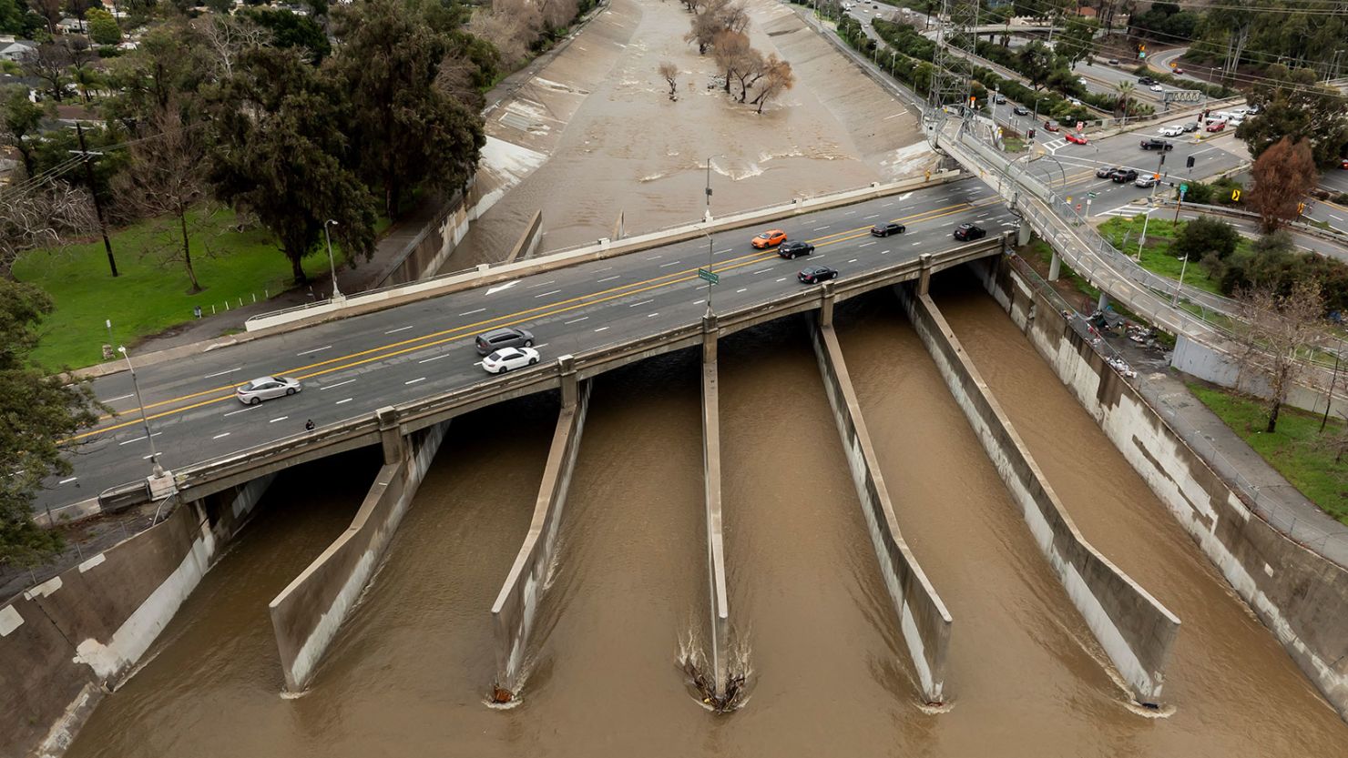
California continues to recover from a potent storm earlier this month that brought record-breaking rainfall and triggered hundreds of mudslides in the southern parts of the state.
While the storms forecast this weekend are not anticipated to be as severe, multiple parts of California and southern Oregon could see rainfall totals over 4 inches by the end of Tuesday.
The second storm on Sunday will be slow-moving, which will ramp up the potential for significant flooding in California, where more than 30 million people are under flood watches this weekend.
The rain that fell in Northern California on Saturday will spread farther south along the Central Coast on Sunday and into Southern California late Sunday through Tuesday.
The stronger second storm will bring “multiple rounds of heavy rain, gusty winds, cooler temperatures, and high-elevation snow to the region late Sunday evening through Wednesday,” the National Weather Service in Los Angeles said.
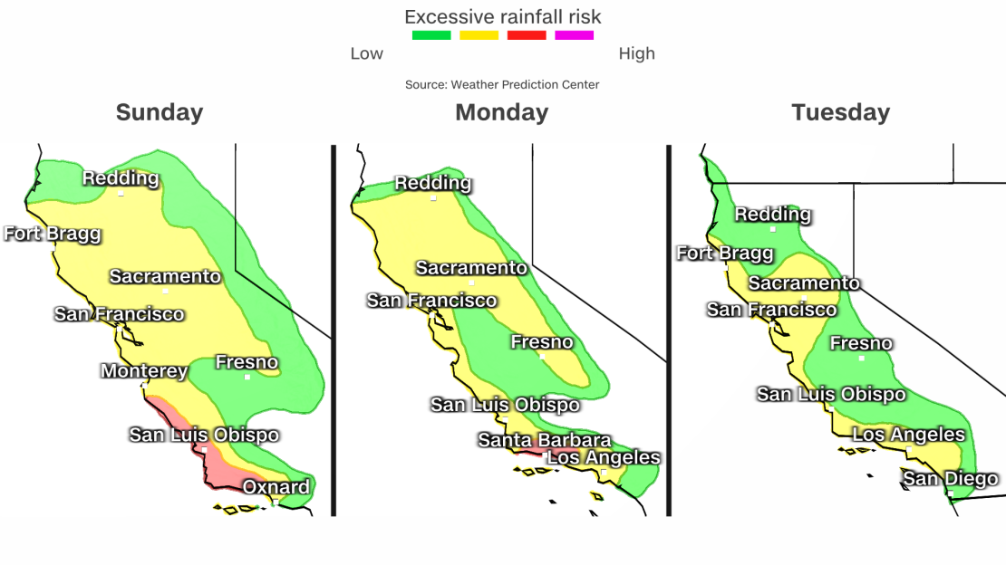
The Weather Prediction Center has issued excessive rain and flash flooding outlooks through Tuesday, and the risk peaks at a Level 3 of 4 for Sunday and Monday.
Major cities facing the biggest risks over the next several days include Santa Barbara with a Level 3 of 4 risk on Sunday and Monday, and Los Angeles with a Level 2 of 4 risk on Monday and Tuesday.
The city of San Francisco is providing residents and businesses with 10 free sandbags. Officials are concerned about “excessive runoff from moderate to heavy rain,” which may lead to flooding, according to a post from the city on X.
Heavy mountain snow to make travel difficult
The National Weather Service office in Sacramento said the storm arriving Sunday afternoon will bring heavy mountain snow, more widespread precipitation, gusty winds and thunderstorms into the evening.
Winter Storm Warnings are in effect for the Sierra and southern Cascades. The first storm was forecast to drop between 4 and 10 inches of snow to the higher elevations by early Sunday, with heavier snow anticipated with the arrival of the second storm.
Snowfall totals in the Sierra Nevada could reach up to 1 to 2 feet for areas above 5,500 feet in elevation, and the highest peaks could see up to 4 feet of snow.
A Winter Storm Warning has been issued for the Greater Lake Tahoe area, including the Sierra passes, going into effect Sunday at 4 p.m. through Wednesday morning. The storm is expected to bring heavy snowfall and gusty winds, which will make for “very difficult” travel conditions in the Sierra early next week, according to the National Weather Service in Reno.
Travel could be very difficult to impossible across Sierra passes including Donner Summit, Echo Summit and Carson Pass,” the Reno office said, warning travelers of increased traffic during the holiday weekend and to prepare for longer commute times and possible travel delays.
The weather service expects heavy wet snow to arrive on Sunday evening, with several feet of snowfall possible by midweek.

