
The iconic cone graphic used by the National Hurricane Center to depict the potential path of tropical systems will undergo a noticeable change for the upcoming hurricane season.
The cone will be deemphasized over land in the continental US, with more emphasis being placed on expected impacts by showing tropical storm and hurricane watches and warnings instead. This means you’ll see active tropical alerts instead of a cone where applicable over land.
Watches and warnings used to only be shown alongside the cone “in a line along the coastline of the affected area,” NHC director Michael Brennan told CNN. Now, the alerts are taking “precedence over the cone,” and “will be predominant on the graphic,” NHC spokesperson Maria Torres told CNN.
The changes aim to address shortcomings in how people perceive a storm’s threats based on the boundaries of the track forecast cone, which only depicts the potential track of the center of a storm and not the storm’s hazards.
A recent study found people perceive areas highlighted within the cone as “at risk” and areas that are outside of it as being “safe.” Researchers refer to this perceived notion as the “containment effect.”
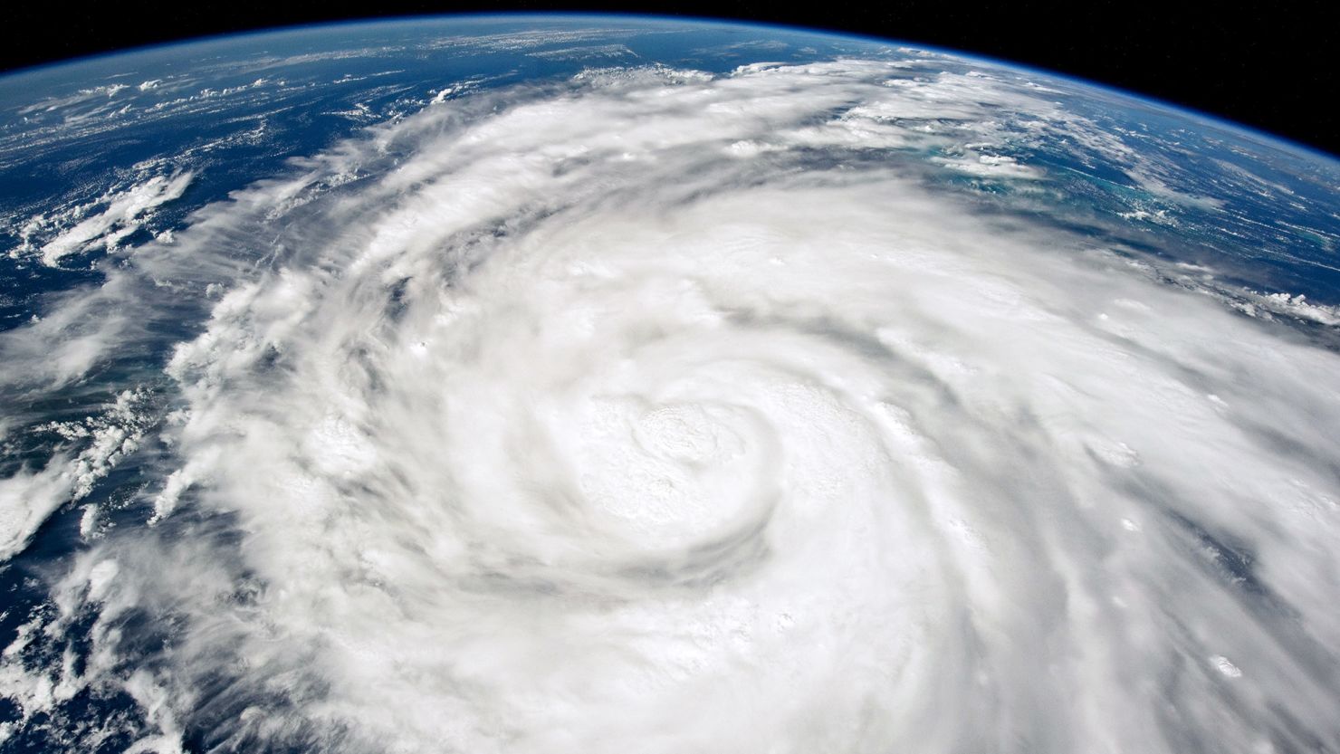
A storm’s winds can be expansive and stretch well beyond the cone.
“This is most critical for strong hurricanes that can carry tropical storm and hurricane force winds well inland, but it will improve the risk communication for wind hazards for all tropical cyclones,” Brennan said.
Tropical storm and hurricane watches and warnings are used to indicate the impending risk of winds of tropical storm force (39 to 73 mph) or hurricane force (74 mph-plus) in a given area, independent of the cone.
Brennan said the decision was based in part on research that tested “alternative cone variations.”
“The inclusion of inland wind risk information on the cone graphic decreased focus on the storm track and increased focus on wind hazard information compared to the versions of the cone without inland watches and warnings,” Brennan said.
The track forecast cone is designed to show where the center of a storm could be over the next five days. Statistically speaking, the longer the forecast period, the greater the likelihood for track error. The cone is much wider five days out compared to 24 hours out to account for the increase in potential track errors.
Every storm’s forecast is different and can have more or less error, but the width of the cone represents the majority of track errors from past storms over a five year period. This means the center of a forecast storm remains within the cone on average 60% to 70% of the time, according to the hurricane center.
But given that the effects of tropical storms and hurricanes often extend much farther than this defined boundary, it can be confusing for the public which may be trying to make critical decisions about preparations or even evacuations.
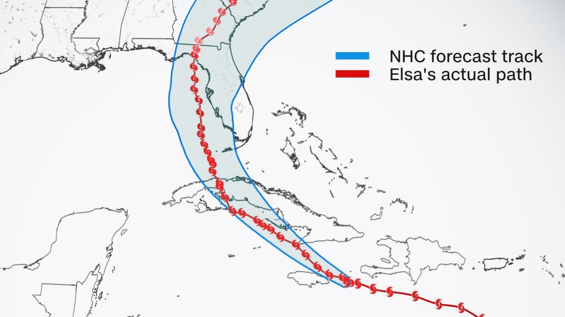
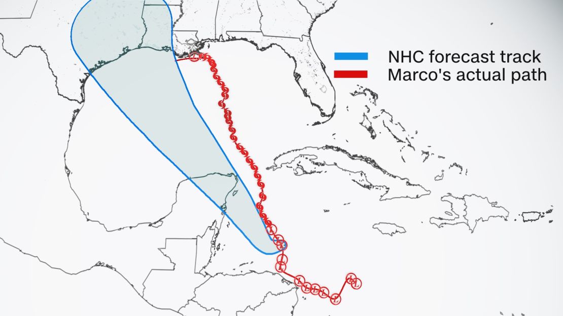
Two different hurricane forecast examples from the past highlight the difficulty in forecasting and the risks of paying too much attention to the traditional cone.
The forecast track for Hurricane Elsa in 2021 five days before landfall in Florida was almost an exact match of where the storm actually tracked. The consistency made it much easier for people to prepare.
But in the case of Hurricane Marco in 2020, the center of the storm tracked outside of the cone originally issued five days before its approach to the Gulf Coast.
You may not have been ready for Marco if you based your hurricane preparedness plans solely off of its cone.
The cone graphic change will be experimental for the 2024 hurricane season in both the Atlantic and Eastern Pacific basins. Brennan said that feedback during this phase will be used to determine whether this change will be permanent or if any other changes are needed in the future.

