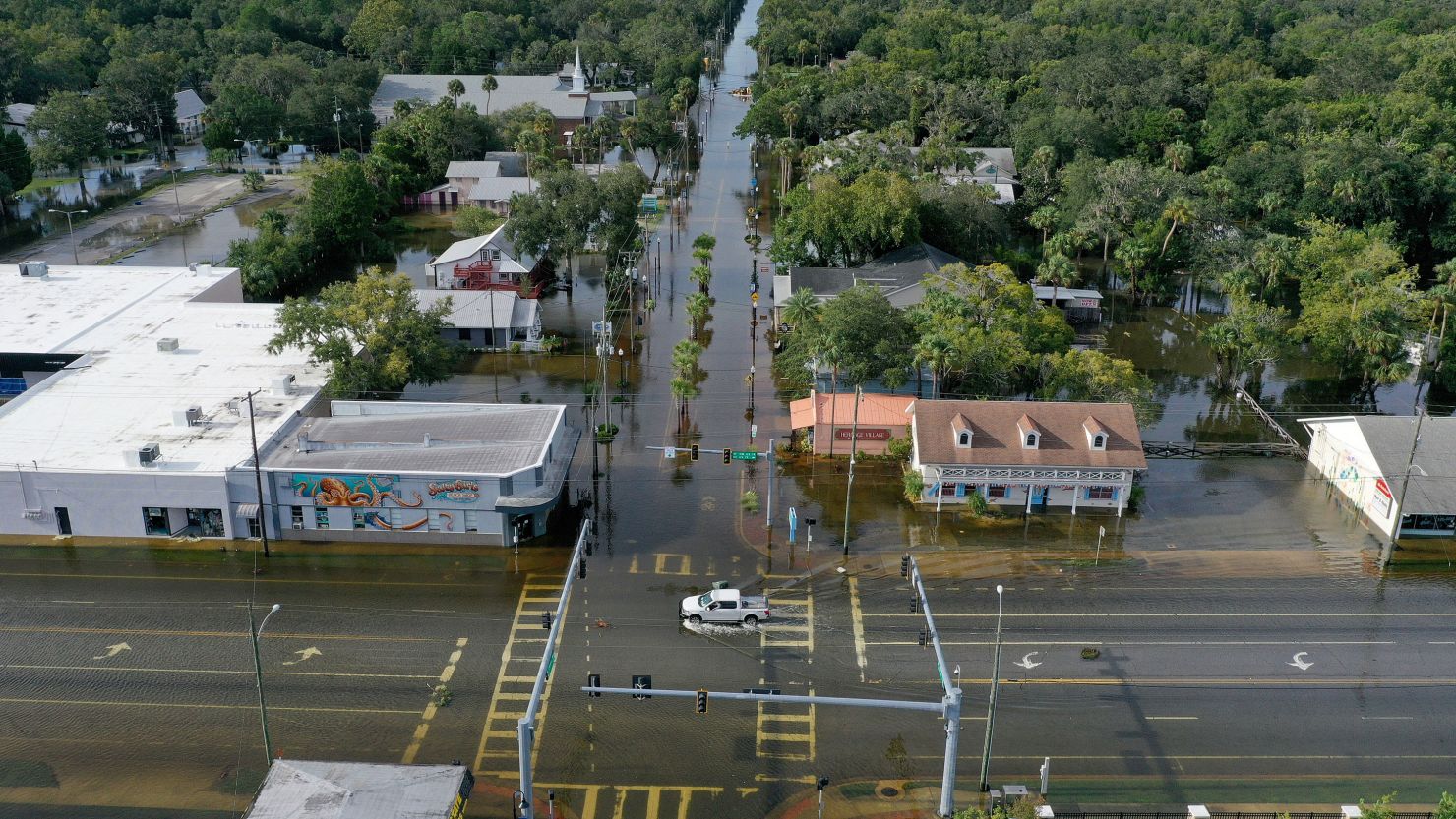
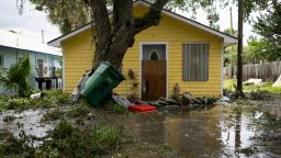
Hurricane Idalia caused “significant damage” after it ripped into Florida’s Big Bend with 125 mph winds and record-setting storm surge. But the storm’s evolution before landfall, and lucky timing with the tides, likely prevented an even worse disaster.
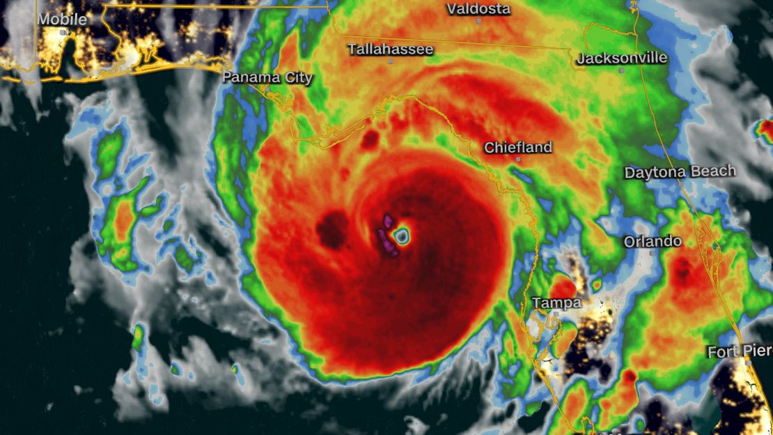
Forecasts from the National Hurricane Center called for Idalia to rapidly intensify and strengthen all the way up to landfall. And for 24 hours, that proved to be true. The hurricane’s winds increased by 55 mph, pushing Idalia into a 130-mph, Category 4 – a rate of intensification so exceptional it ranks in the top 0.4% of Atlantic storms since 1982, according to NOAA research meteorologist John Kaplan.
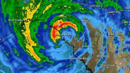
But then something changed. On Wednesday morning, with the storm just 20 miles and 45 minutes from landfall, the hurricane center announced Idalia’s winds dropped 5 mph because it was undergoing an eyewall replacement cycle.
An eyewall replacement cycle is akin to a snake shedding its skin. Strong hurricanes can shed a smaller eyewall – the ring of most intense winds that surrounds the hurricane’s calm eye – in favor of a larger one. During this process, the storm’s winds can weaken, but when it’s complete, the storm will be larger and can then start to intensify even further.
Idalia’s landfall kept this process from completing, preventing the hurricane from being even larger and more intense than forecast at landfall.
“If it would have been six or 12 hours more over water, I think a totally different hurricane would have made landfall,” Jamie Rhome, Deputy Director of the National Hurricane Center told CNN.
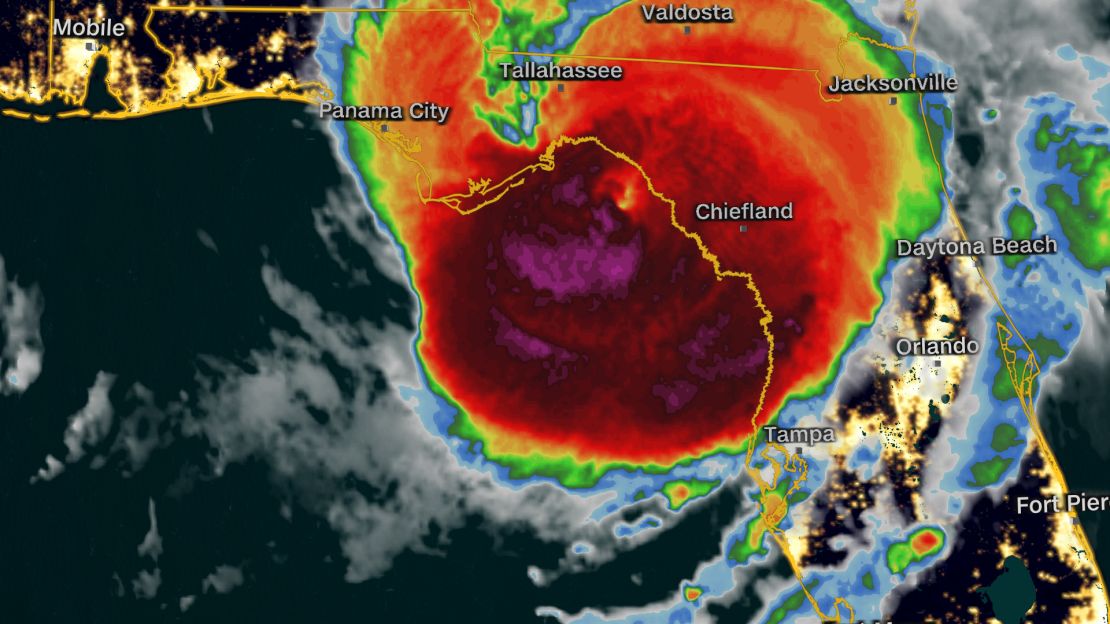
Even Idalia’s incomplete eyewall cycle could have had a “massive” effect on what people experienced, Rhome said. The hurricane’s structure was changing, which affected where the strongest winds were set up and who got the worst surge as a result. A small, condensed eye could produce higher surge, but over a more confined area, Rhome said.
In those kinds of storms, “the swath of surge is so tiny you could literally walk across it,” said Rhome. Hurricane Charley was one such example: it made landfall as a Category 4 hurricane but only produced 6 to 7 feet of surge over a small area.

But in the case of Idalia, the wind field was expanding during the eyewall replacement cycle, which means it could have broadened the scope of the surge at the expense of its peak intensity.
“It would dramatically change where surge happens,” Rhome said. “I can’t put into words just how sensitive surge is to the wind. Not just the wind speed, but also the wind direction, too. These structural changes can also change the angle of the wind, which can have dramatic impacts on the surge or the timing of the wind (and the surge) relative to the tide.”
The tides were another key factor in the severity of the surge, especially in Cedar Key, Florida.
“The other thing that happened with Cedar Key is the (storm’s) timing changed,” Rhome said. “It, luckily, luckily came in at low tide, which probably whacked, you know, four feet off of (the surge), just with that.”
Rhome said post-storm analysis will be done to better understand exactly what effect the eyewall replacement cycle and other factors had on Idalia. Surveys will also be done to determine just how bad the storm surge was, which is complicated by the fact that there are very few tidal gauges in this area to actually measure the storm surge.
A CNN analysis of the National Hurricane Center’s forecast showed it was nearly spot-on. Five days before landfall, the forecast was within 10 miles of where Idalia’s center would eventually come ashore. And by early Monday, the forecast was already calling for a Category 3 at landfall. Rhome also said he believes the surveys will show there was widespread 10 feet of storm surge, which was also in the forecast.
But not everything can be so accurately predicted, and Idalia showed the minutiae of something as complicated as a hurricane can make a big difference on what people actually experience.
Rapid intensification and eyewall replacement cycles – specifically, the timing of them – are some of the most difficult things to forecast in the field of meteorology. Forecasters know when they are likely, Rhome said, but it’s “next to impossible” to know when they will complete.
“There’s a societal expectation of perfection in these forecasts that exceeds the limits of predictability – society’s desire to know precisely what’s going to happen at their doorstep five days prior,” Rhome said. “While I understand that need, there’s just no science right now that would allow us to provide that.”

