


Harold has weakened to a tropical depression as it continues to plow through Texas, triggering flash flooding and tornado warnings as the gusty storm pushes toward Mexico.
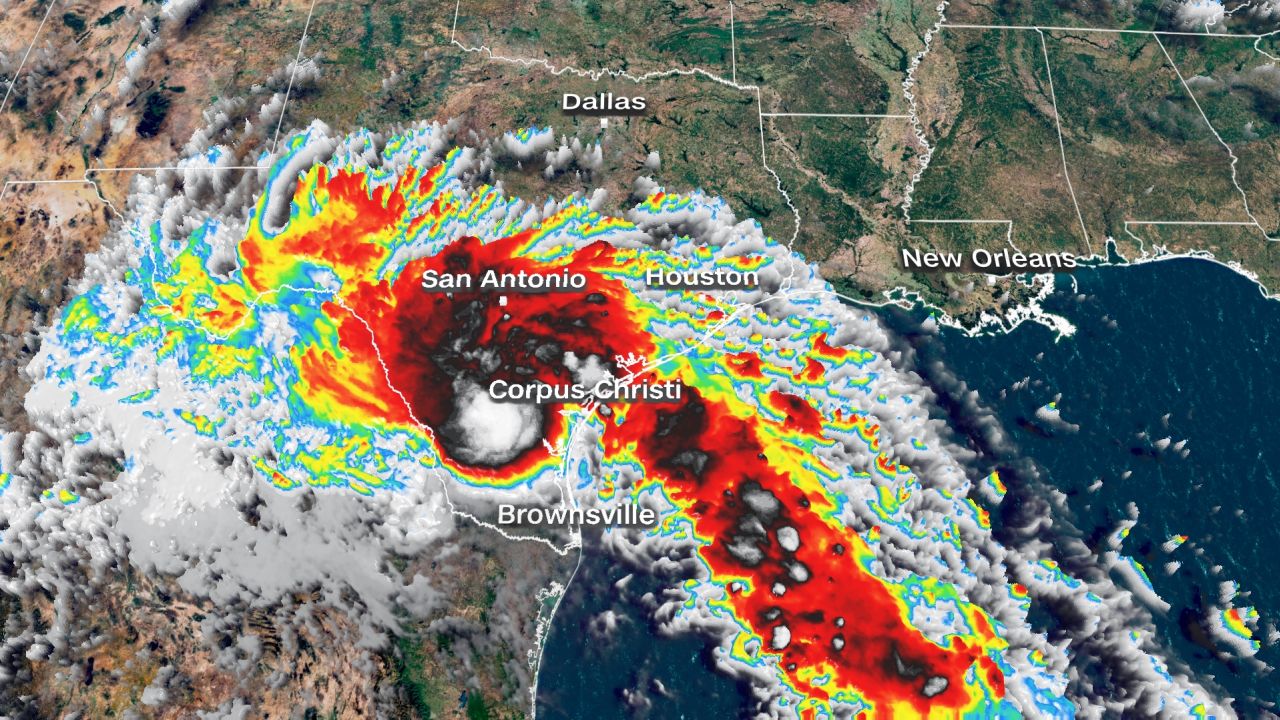
Harold made landfall as a tropical storm just before 10 a.m. CT (11 a.m. ET) on Padre Island, Texas, with sustained winds of 50 mph and gusts as high as 67 mph, becoming the first storm to come ashore in the United States in the 2023 Atlantic hurricane season.
The storm now has 30 mph sustained winds, according to a 5 p.m. ET advisory from the National Hurricane Center, and all tropical storm warnings along the Texas coast have been discontinued.
The center of the storm is about 15 miles east of Laredo, Texas, and will continue moving into northern Mexico over the next few hours.
Heavy rain and strong winds will continue to slam portions of southern Texas and Mexico as Harold tracks westward. Those winds had knocked out power to around 20,000 customers in Texas as of Tuesday evening, according to poweroutage.us.
Harold will be able to dump 3 to 5 inches of rain across South Texas on Tuesday and Wednesday with locally higher amounts closer to 7 inches. Across Mexico, 4 to 6 inches of rain are expected.
The heaviest rain tonight will occur across northern Mexico, where up to 10 inches is possible.
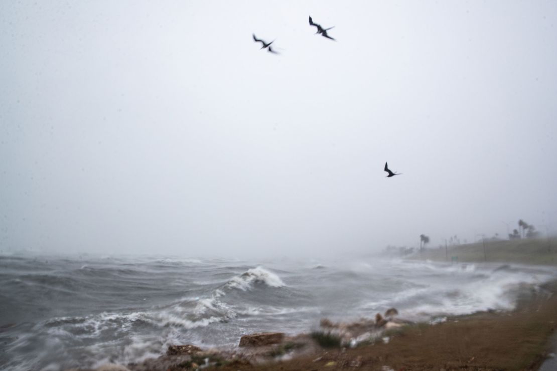
Life-threatening surf and rip currents conditions will last across the southern Texas coast through Tuesday, and it’s possible the state may also see a few tornadoes develop. The National Weather Service issued several tornado warnings in South Texas early Tuesday afternoon.
The storm is moving across southern Texas as the state continues to battle one of its hottest, driest summers on record.
Corpus Christi, Texas, already recorded more rain in just a few hours than it has received for the entire summer, according to National Weather Service data. Widespread amounts of 1 to 2.5 inches of rain fell over the area and points south from Tuesday morning into the early afternoon.
While this tropical system’s rains could help quench parts of the drought-stricken state, some of the worst drought conditions – areas of extreme and exceptional drought in Central Texas – might miss out on much of the rain.
Texans geared up ahead of Harold’s arrival. Texas Gov. Greg Abbott deployed the Texas National Guard, swift water rescue boat squads, among other emergency resources. Naval Air Station Kingsville ordered those in the RV Park on the installation to evacuate, while voluntary evacuations were called in Riviera, Baffin Bay and Loyola Beach, authorities said.
Franklin packing potentially life-threatening flooding
Tropical Storm Franklin is set to slam Hispaniola by Wednesday with life-threatening flooding and mudslides. The storm will also bring heavy rainfall to Puerto Rico.
Franklin had sustained winds of 50 mph as of Tuesday afternoon and was located over the Caribbean Sea about 230 miles south-southwest of Santo Domingo, Dominican Republic. The storm made a northward turn early Tuesday afternoon and will continue in that direction until it makes landfall in Hispaniola Wednesday.
Franklin will unload very heavy rain across Hispaniola Tuesday through Wednesday and raise the threat of flash flooding and mudslides. Isolated rainfall amounts up to 15 inches are possible. Up to 6 inches of heavy rain could fall in Puerto Rico through Thursday, but the island will escape the worst of Franklin.
The Atlantic hurricane season is ramping up. Three tropical systems formed in 24 hours Saturday into Sunday. Harold now marks the fourth in four days.
CNN Meteorologist Jennifer Gray and CNN’s Amanda Jackson and Joe Sutton contributed to this report.


