
After months of extreme drought in the West triggered unprecedented water cuts and primed the landscape for massive wildfires, the final stretch of 2021 gave a tiny glimpse of hope for drought-weary Californians.
Storms were coming.
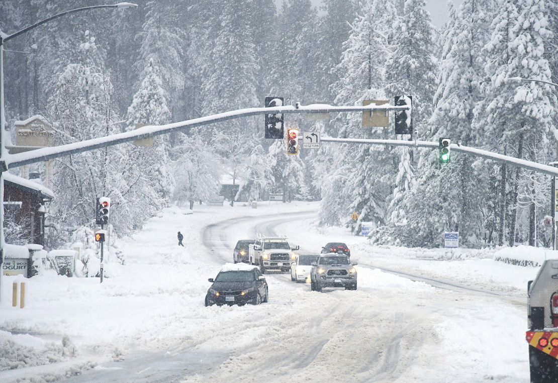
California – facing back-to-back dry years and record-breaking heat waves that pushed the drought into historic territory – got a taste of the rain it was looking for in October, when the first big storm of the season pushed onshore. Then in late December, more than 17 feet of snow fell in the Sierra Nevada, which researchers said was enough to break decades-old records.

Climatologists were cautiously elated as they watched snow pile as high as some roofs. But they still were going to need much more to make headway on the drought, said Andrew Schwartz, the lead scientist and station manager at the University of California, Berkeley’s Central Sierra Snow Laboratory.
“We are really concerned about the upcoming months not having as many storms,” Schwartz told CNN at the time.
That’s exactly what happened in January, which is expected to go down as the driest on record for many parts of the state. Climatologists are now worried about the severity of the drought in the months to come. On Thursday, 66% of California was in severe drought, the US Drought Monitor reported.
Precipitation “flatlined” last month, according to Daniel Swain, a climate scientist at UCLA and the National Center for Atmospheric Research. Statewide snowpack, which had been at 160% of normal in December, is down to around 90% due to the lack of new accumulation and some midwinter melting, he said.
Schwartz’s snow lab – where the 17 feet of snow fell in December – got just 9 inches in January. Twenty out of the state’s 30 major climate stations reported their top five driest Januarys on record.
Last month is expected to be the driest January on record – since at least 1895 – across the central and southern Sierra Nevada, much of the San Joaquin Valley and parts of the Sacramento Valley and Central Coast, Swain said, based on preliminary data. The National Oceanic and Atmospheric Administration will release the final statistics in the coming days.

“It’s extremely fortunate that October and December 2021 were very wet months in California, as otherwise this extremely dry January and start to February would have produced pretty dire consequences,” Swain said.
The climate crisis is making droughts more severe and more frequent, scientists have reported. The consequences of the crisis were clear this summer when officials in the West announced the first water cuts on the Colorado River. In California, Gov. Gavin Newsom declared a drought emergency to “step up their water conservation efforts.”
Climate change has also increased the potential for dramatic swings in weather. In California, this has led to extended periods of extreme drought with short bursts of high precipitation. Scientists say the chances of sudden transitions, also known as weather whiplash, will become more common in the coming decades.
“A big part of what we’re seeing is natural variability of the climate system, but anthropogenic climate change has enhanced those natural drought signals,” Schwartz said. “That is why we’re seeing consecutive years of extreme drought mixed with higher precipitation amounts from the storms that do occur.”
Warmer temperatures are also eating into the state’s high-elevation snowpack, which serves as a natural reservoir that eases drought, storing water through the winter months and slowly releasing it through the spring melting season. Snowpack in the Sierra Nevada accounts for 30% of California’s fresh water supply in an average year, according to the California Department of Water Resources.
The state’s major man-made reservoirs, which are replenished by rainfall and spring snowmelt, are at levels around 75% of average for this week. Ideally, they would be above 100% to ensure there’s enough water for the dry months to come, Schwartz said.
“We still need about 8 feet of snow here at the lab to hit our season average and then any additional snow will go towards relieving the drought,” Schwartz said. “At this point, we’re looking at needing several above-average precipitation winter seasons to really pull us out of the drought.”
Although the drought is not as severe right now as it was over the summer, it could “potentially reintensify if rain and snow do not return in the coming weeks,” Swain said.
Still, the precipitation outlook for the rest of the winter and the coming spring is drier than average, Schwartz and Swain said.
“It’s not looking like we’ll see any relief from our dry weather pattern anytime soon,” Schwartz said.

