Two storms, including another long-lasting atmospheric river event, will drench much of California starting Saturday and well into next week, raising the risk of flooding and landslides.
The state is still recovering from a particularly potent storm that brought record-breaking rain and hundreds of mudslides to Los Angeles and other parts of Southern California in early February.
The two storms aren’t forecast to be as devastating as early February’s, but the repeated rounds of rain and the slow-moving nature of the second storm will bring a significant threat for flooding.
As a result, more than 27 million people are under flood watches stretching from Northern California south to parts of the Los Angeles area.
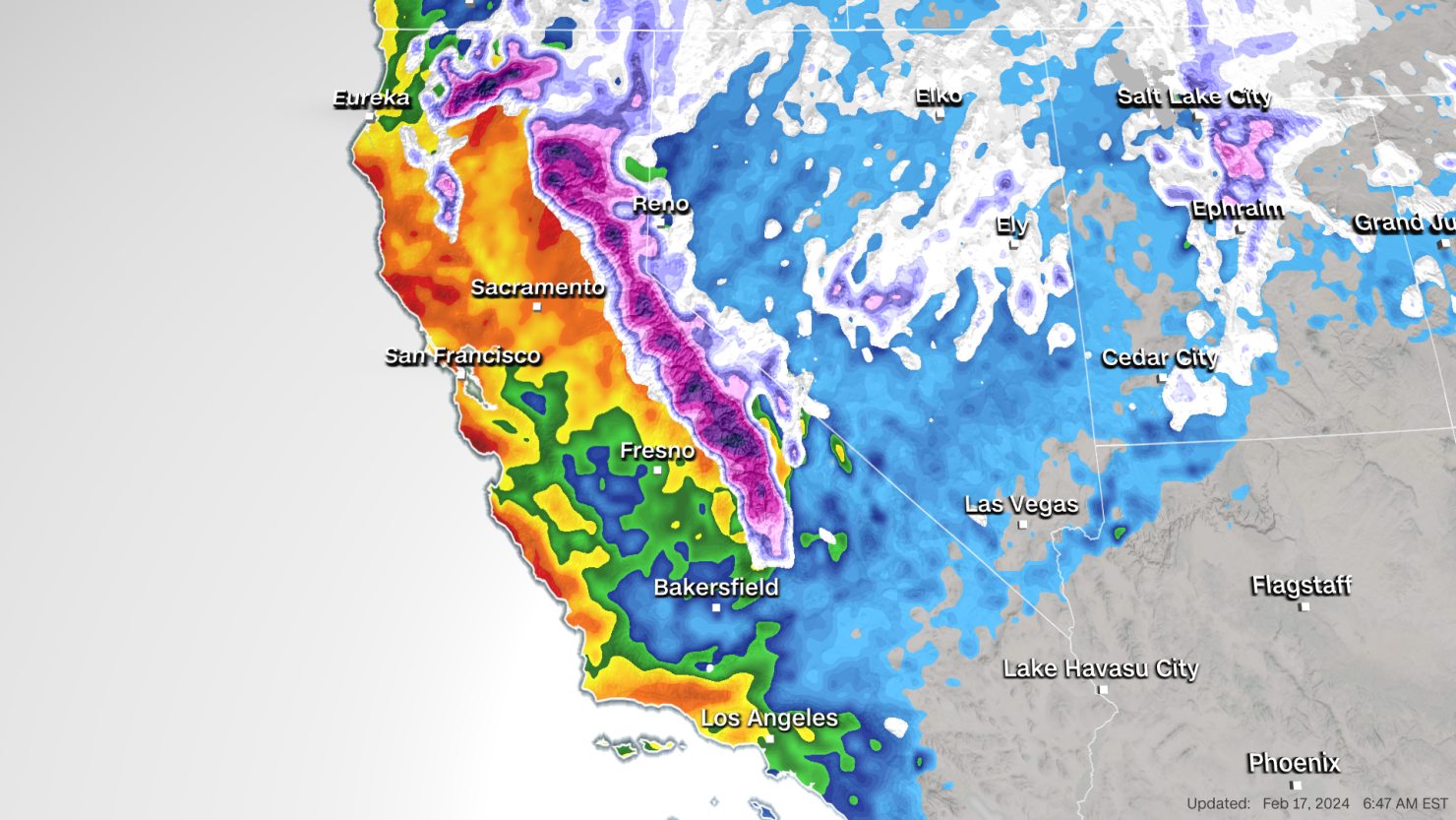
The first storm is expected to be weaker than the second, but “will act as a primer, increasing soil moisture and causing the streams and rivers to rise before the heavier rain on Sunday” from the second storm, the National Weather Service said. It will march into the Northern California coast early morning Saturday and spend the rest of the day soaking the region with 1 to 2 inches of moderate rainfall. Only light rain is expected in the Central Coast and Southern California.
Emergency management officials in Santa Barbara County issued evacuation warnings in some parts of the county on Saturday ahead of the expected storm.
The second, more potent storm will arrive on Sunday afternoon and stall near the coast into early next week, increasing the potential for excessive precipitation through Wednesday across much of the state. The National Weather Service issued a flood watch for the county beginning Sunday afternoon and lasting through Wednesday morning.
Impactful weather in the northern part of the state will mostly occur on Sunday, with 1 to 3 inches of rain in the lowlands and 3 to 5 inches expected in higher elevations.
“Soils around the Bay Area are near saturation, so the rainfall will runoff quickly and likely contribute to numerous shallow landslides along areas of steep terrain,” the National Weather Service office in San Francisco said.
There will also be gusty winds, but not nearly as severe as the deadly hurricane-force gusts in the early February storm that knocked out power to hundreds of thousands. Wind gusts of 35 to 50 mph are most likely Sunday night into Monday and “could lead to more downed trees and potential power outages,” the San Francisco forecast office said.
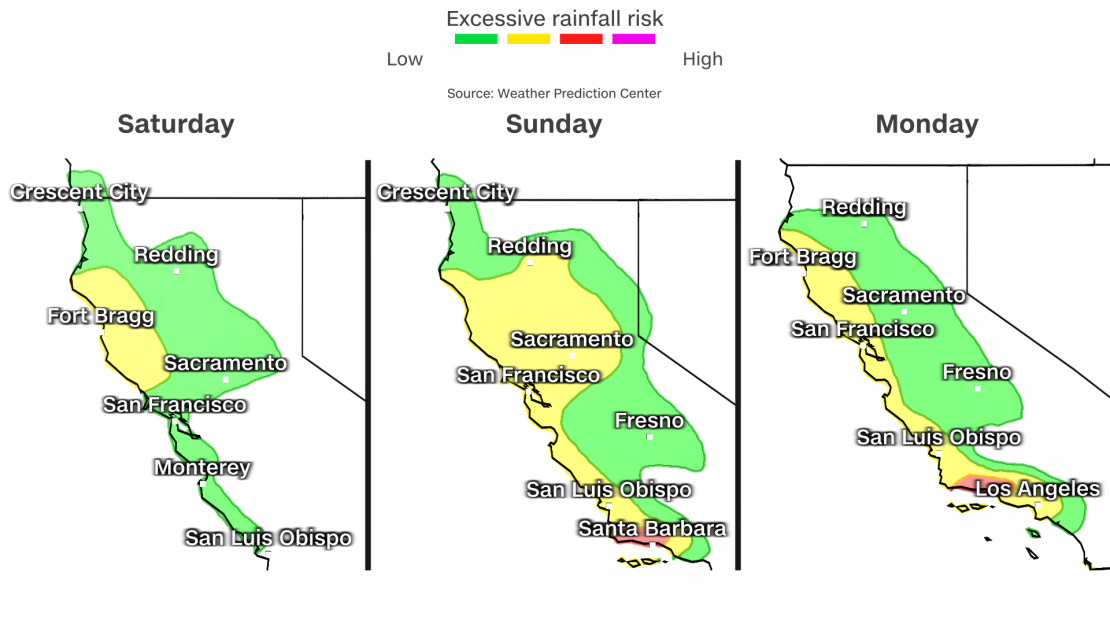
The heaviest rain will begin to shift south late Sunday and early Monday, enveloping the Central Coast and parts of Southern California. Santa Barbara in particular is under a Level 3 of 4 risk for flooding rain starting Sunday and lasting through Monday night.
By Monday afternoon the heavy rain reaches Los Angeles, where a Level 2 of 4 risk for flooding rain is in place from Tuesday into early Wednesday.
“Rainfall rates in this region have the potential to reach 0.5 to 1 inches per hour, with over 1 inch per hour rates possible,” the Weather Prediction Center said. Rainfall totals of 2 to 4 inches are forecast in coastal areas and 4 to 6 inches in higher elevations from Sunday to Wednesday.
“This amount of rain along with last week’s totals will bring significant concerns for flooding and landslides,” the National Weather Service office in Los Angeles said.
While the coast is to be drenched with significant rainfall, higher elevations are forecast to receive more snow.
Saturday’s storm is going to be the weaker of the two systems in terms of snow accumulation, with 4 to 10 inches of snow expected in high elevations of the Sierra Nevada and southern Cascade mountains by Sunday morning.
“Mount Shasta could easily see two feet of snow accumulation Saturday/Saturday night across their high terrain which may lead to some happy folks at the ski park,” says the National Weather Service office in Medford, Oregon.
The second storm, however, has a lot more snow to bring to the region.
By Wednesday, snowfall totals in the Sierra Nevada could reach up to 1 to 2 feet for areas above 5500 feet in elevation, and the highest peaks could see up to 4 feet of snow.
“Mountain travel is highly discouraged while the Warning is in effect, as potential impacts include difficult to impossible travel conditions, snow covered roads, chain controls, reduced visibility and road closures,” warns the National Weather Service office in Sacramento.

