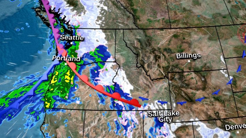
Another strong atmospheric river is set to barrel into the Northwest late Monday and dump over half a foot of rain on the already soaked region, setting off a significant flood threat.
Monday’s storm is the latest in a seemingly never-ending train of atmospheric rivers slamming the region, with each increasing the flood risk more than the last. Several inches of rain and feet of snow have fallen since late Friday, but Monday’s event will transport much warmer air and drench even high, snow-covered elevations with rain, increasing the flood threat.
Flood watches were issued for over 10 million people across the Northwest on Monday ahead of periods of heavy rain set to target portions of Washington, Oregon, Northern California and Idaho through Wednesday. A Level 3 of 4 moderate risk of excessive rainfall was also in place Monday in northwestern Washington.
An atmospheric river directs tropical moisture from the Pacific straight to the West Coast in the form of heavy rain and snow and is the Northwest’s hallmark type of winter storm.
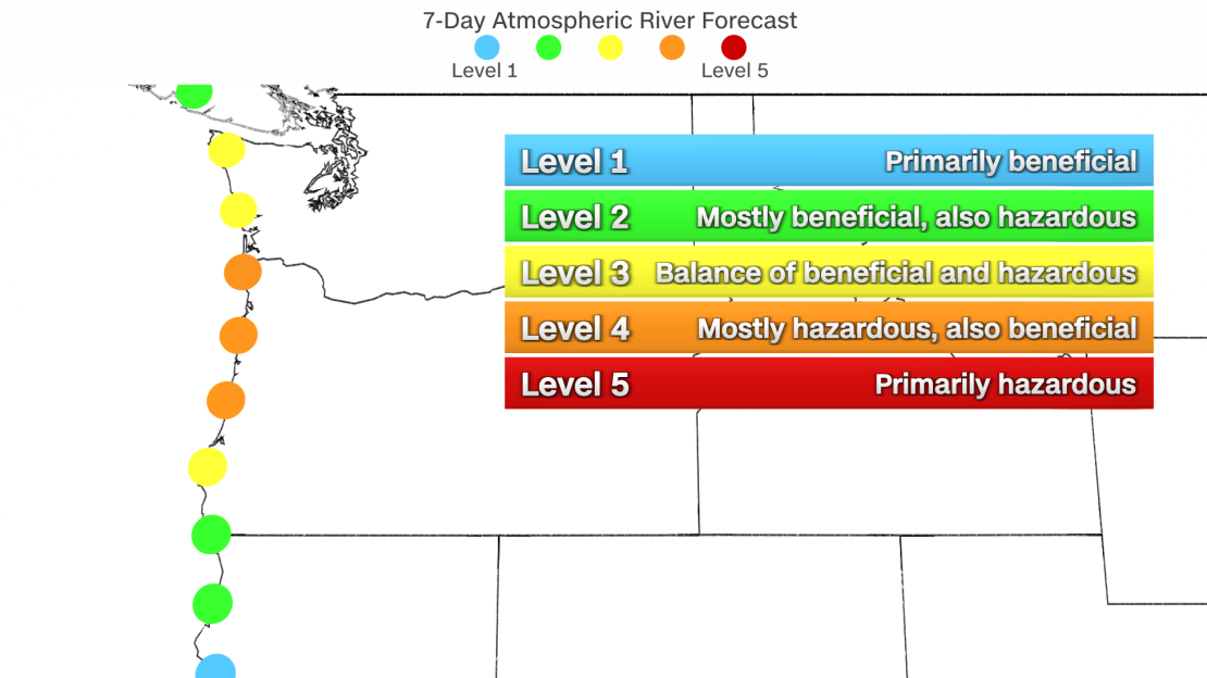
Atmospheric rivers are categorized on a five-point scale, with 1 describing “weak” storms and 5 classified as “exceptional.” This week’s event is considered a Level 4 out of 5, or “extreme,” atmospheric river for much of the Oregon coastline and a Level 3 out of 5 “strong” event for the Washington coast.
The heaviest rainfall will begin Monday evening from coastal Washington and Oregon into the Cascade mountains. Parts of the Cascades that were buried in snow over the weekend may record more than a foot of rain from late Monday through Wednesday.
Outside of the mountains, rainfall amounts in western Washington and western Oregon could climb into the 3 to 6 inch range this week.
This amount of rain is enough to raise rivers on its own, but the impact of this week’s heavy rainfall will be increased because it will fall so soon after the area was deluged with rain and snow over the weekend.
The first atmospheric river of this multi-day event unloaded more than 4 inches of rain from Saturday to Sunday on parts of Washington, Oregon and California, reducing the ground’s ability to absorb more water.
The same event also dumped heavy snowfall across the Cascades and northern Rocky Mountains. In Washington, Stevens Pass recorded 40 inches of snow over the weekend and several other locations in the state recorded more than 30 inches.
Rainfall melts snow, and that melted snow will then flow into streams and rivers, causing even higher rises on rivers or flooding low-lying areas.
As a result, some rivers in western Washington are forecast to reach moderate and major flood stage this week. The Skagit and Snoqualmie rivers are of particular concern, with both forecast to flood roads, farms and even some residential areas in spots.
As heavy rain pours down on deep snow in the mountains, another incredibly dangerous hazard arises: avalanches.

An avalanche warning was in place over the weekend for portions of Washington and Oregon and it’s likely more will be issued in the coming days.
Heavy rainfall may also trigger landslides or debris flows in areas burned by wildfires because the ground is less able to absorb it effectively.
By Thursday and Friday, storm activity is forecast to scale back across much of the Northwest, but showers and some high-elevation snow remain possible.
There are some early signs in forecast computer models of yet another atmospheric river hitting the region by the early weekend.
The exact strength and overall impact of this potential event should become clearer once this week’s atmospheric river comes to an end on Wednesday.
CNN’s Allison Chinchar, Sara Tonks and Robert Shackleford contributed to this report.

