Chicago airports topping list as flight delays and cancellations rise

Powerful winter storm hits eastern half of the US

By Mary Gilbert, Elizabeth Wolfe, Eric Zerkel, Adrienne Vogt, Zoe Sottile and Tori B. Powell, CNN

Updated 1820 GMT (0220 HKT) January 13, 2024
19 Posts
Sort byDropdown arrow
11:51 a.m. ET, January 12, 2024

Chicago airports topping list as flight delays and cancellations rise

Passengers stand in line at O’Hare International Airport in Chicago on Friday.
Passengers stand in line at O’Hare International Airport in Chicago on Friday. Network Video Productions

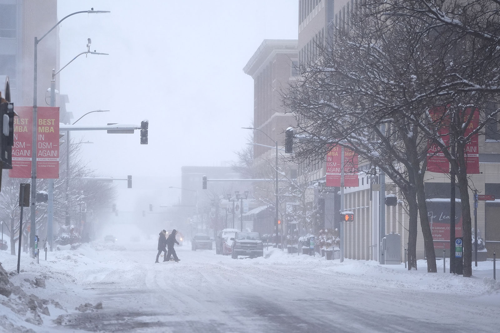
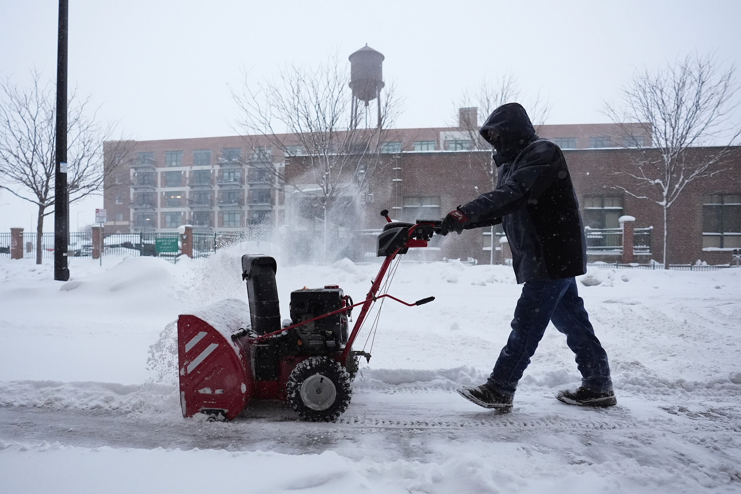
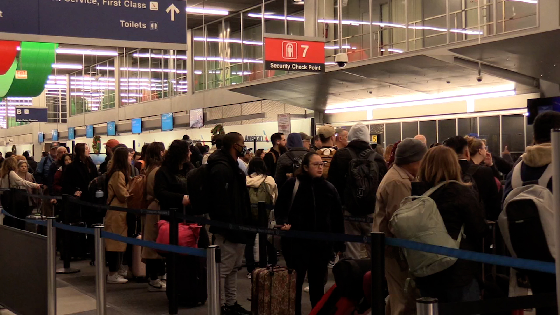
The number of flight delays and cancellations is ticking up as the Midwest and South are experiencing messy conditions due to the storm.

According to the flight-tracking website FlightAware.com, there have been over 2,400 delays and 1,850 cancellations in the US today so far.

It's the highest number since July 2023, according to the data from FlightAware.

Chicago-area airports are leading that list, with O'Hare International Airport canceling almost 40% of its flights out and 36% of its inbound flights, and Chicago Midway International Airport canceling about 60% of both outbound and inbound flights.

Other affected airports include Denver International and Milwaukee Mitchell International.

Max factor: Cancellations due to the grounding of the 737 Max 9 planes are also contributing to the totals. More than 200 United and Alaska Airlines flights have been canceled each day this week due to the Federal Aviation Administration-mandated grounding. The FAA and Boeing are still trying to settle on an inspection protocol that would allow those planes to resume flying. 

Most of the cancellations, however, are due to the winter storm. FlightAware shows Southwest, which doesn’t fly the 737 Max 9, canceling nearly 400 flights — the most of any airline.

CNN's Ross Levitt and Pete Muntean contributed reporting to this post.

11:15 a.m. ET, January 12, 2024

Over 245,000 utility customers without power as outages climb in Illinois

Power outages are climbing as the storm unleashes severe thunderstorms in the South, blizzard conditions in the Midwest and strong wind gusts for the more than 150 million Americans under wind alerts Friday.

Nearly 250,000 homes and businesses are without power in the Great Lakes and South as of Friday morning. Most of the outages are in Illinois, where more than 97,000 are in the dark, and winds have gusted as high as 55 mph at Chicago's O'Hare International Airport.

Severe thunderstorms racing across the South have produced wind gusts as high as 74 mph in Arkansas. 

Here are the top outages by state as of 10:30 a.m. ET:

  • Illinois: 97,320
  • Texas: 37,422
  • Wisconsin: 24,068
  • Arkansas: 22,719
  • Mississippi: 20,463

11:06 a.m. ET, January 12, 2024

Chicago just experienced thundersnow. Here's what that is

From CNN Meteorologists Mary Gilbert and Brandon Miller

Lightning flashes (greens, yellows and reds) are overlaid on top of a satellite image depicting the large storm impacting the eastern half of the US. A faint, brief flash is seen in Illinois, indicating the thundersnow.
Lightning flashes (greens, yellows and reds) are overlaid on top of a satellite image depicting the large storm impacting the eastern half of the US. A faint, brief flash is seen in Illinois, indicating the thundersnow. NOAA

Satellite imagery captured at least two flashes of lightning occurring over the Chicago area on Friday morning. What’s strange is, the city was experiencing heavy snow and not rain at the time.

Instead of a typical thunderstorm, what unfolded Friday morning was something called thundersnow

Thundersnow is exactly what the name suggests – a snowy thunderstorm. It’s a rare phenomenon that occurs in incredibly strong winter storms and sometimes during intense lake-effect snow.  

Typical thunderstorms are fueled by atmospheric instability, which develops from moisture and heat in the atmosphere. As such, lightning is much more common during warmer parts of the year or in warmer locations.  

But lightning isn’t impossible during cold months since very powerful storms like Friday's can generate plenty of atmospheric instability. A snowstorm can tap into this instability and produce lightning, which is exactly what happened over Chicago.

A snowstorm can tap into this instability and produce lightning, which is exactly what happened over Chicago.

The rumbles of thunder during thundersnow are often muffled by heavy snow. Despite this, lightning strikes during thundersnow are just as dangerous as a typical thunderstorm. 

Still image of lightning (white dots with purple outlines) within snow over Chicago Friday morning.
Still image of lightning (white dots with purple outlines) within snow over Chicago Friday morning. CIRA/RAMMB

11:14 a.m. ET, January 12, 2024

How much snow has fallen? The storm's top totals so far

From CNN Meteorologist Mary Gilbert

Pedestrians cross the street in snowy conditions on Friday in Des Moines, Iowa.
Pedestrians cross the street in snowy conditions on Friday in Des Moines, Iowa. Abbie Parr/AP

As a powerful storm moves east across the US and continues to become stronger, it is enveloping more of the Midwest with snow.

Here are the top snowfall reports as of 10 a.m. ET:

  • Nebraska:
  • 8 inches in Bloomfield
  • 8 inches in Platte Center
  • Iowa:
  • 6.5 inches in Knoxville
  • 6.1 inches in Blakesburg
  • Illinois:
  • 8 inches in Elburn
  • 7 inches in Coal Valley

Totals in these states will likely climb as snow continues to fall.

The storm has also been accompanied by powerful winds.

Here are the strongest wind gusts from thunderstorms so far:

  • 74 mph in Pine Bluff, Arkansas
  • 72 mph in Stuttgart, Arkansas
  • 69 mph in Spriggs Mill, Arkansas
  • 68 mph in Bella Vista, Arkansas

And the strongest non-thunderstorm wind gusts:

  • 55 mph in Chicago, Illinois (measured at Chicago O'Hare International Airport)
  • 53 mph in Aurora, Illinois
  • 52 mph in DuPage, Illinois
  • 51 mph in Chicago, Illinois (measured at Chicago Midway International Airport)
9:54 a.m. ET, January 12, 2024

Every US state is under a weather alert

From CNN Meteorologist Mary Gilbert

A man clears snow off a sidewalk in Des Moines, Iowa, on Friday, January 12.
A man clears snow off a sidewalk in Des Moines, Iowa, on Friday, January 12. Abbie Parr/AP

The massive storm slamming the eastern half of the US is only one piece in a very active weather pattern. Multiple weather hazards are impacting the country Friday morning, so the National Weather Service has issued some kind of weather alert for every state.

Everything from blizzard warnings to tornado warnings are in effect early Friday as the massive storm works its way across the eastern half of the US. Wind alerts stretch nearly 2,000 miles from Texas to New England, while flood alerts span from the mid-Atlantic to Northeast.  

Another robust storm in the Northwest is bringing snow and wind to the region and temperature alerts dot several states as brutally cold air starts to seep south out of Canada. 

Alerts are in effect in Alaska ahead of a winter storm set to impact the state this weekend. Even Hawaii is dealing with the impacts of stormy weather as a potent cold front slices across the islands.

Track winter weather alerts across the US here.

8:27 a.m. ET, January 12, 2024

This storm could bomb out. Here's what that means

From CNN Meteorologist Mary Gilbert

A forecast model shows a powerful storm at its full strength Friday night, producing robust wind gusts while centered over the Great Lakes.
A forecast model shows a powerful storm at its full strength Friday night, producing robust wind gusts while centered over the Great Lakes. CNN Weather

The potent storm tracking across the central US will continue to strengthen on Friday, bringing all modes of hazardous weather to the eastern half of the country.  

At the storm’s peak intensity Friday night, it may strengthen enough to bomb out, or be considered a bomb cyclone: a rapidly strengthening storm that undergoes a significant drop in pressure — a measure of a storm's strength — in a short time. Bomb cyclones are formidable and unload heavy snow and strong winds during the winter. 

A storm must drop at least 24 millibars (which is a unit of pressure) in 24 hours or less to meet bomb cyclone criteria. But technically, the exact millibar drop needed will vary slightly based on the storm’s exact latitude.  

The Weather Prediction Center doesn't show the storm officially hitting bomb cyclone status, but several forecast models showed the potential exists. Bomb cyclone or not, it could end up stronger than the last powerful storm, which set January records for strength as it passed over Indiana.

7:10 a.m. ET, January 12, 2024

Water levels on Maine's coast could rival destructive, historic highs once again

From CNN's Eric Zerkel

A man wades through a flooded parking lot near Widgery Wharf on January 10, in Portland, Maine.
A man wades through a flooded parking lot near Widgery Wharf on January 10, in Portland, Maine. Robert F. Bukaty/AP

Water levels on Maine's coast are forecast to hit historic highs on Saturday, threatening to inflict more damage on coastal communities still reeling after a storm earlier this week sent water surging onshore.

Water levels at gauges from Portland to Eastport were forecast to top levels from Wednesday during the last storm, according to data from the National Oceanic and Atmospheric Administration. Portland and Bar Harbor both hit new historic high-water marks on Wednesday.

The water level reached 15.49 feet in Bar Harbor Wednesday morning and is forecast to top 17 feet by noon Saturday. The previous record in Bar Harbor was 15.04 feet in 2018.

The water is projected to top 14 feet in Portland Saturday morning, slightly higher than the 13.84 feet hit on Wednesday morning, which broke the previous record set in 1978, NOAA said. 

Maine's governor issued a State of Civil Emergency Thursday for all eight of the state's coastal counties after the storm surge caused destruction there.

“Significant rain, wind, and flooding have once again ravaged our state – this time our small communities up and down the coast,” Gov. Janet Mills announced Thursday. “The damage we are seeing is devastating, from working waterfronts, to small businesses, to public roadways and more.”

The exceptionally high water is being driven by strong winds blowing water from the Atlantic Ocean toward the shore on top of high tide. Heavy rain inland only exacerbates the flooding. 

Climate change is also playing a role. Sea levels are rising as global temperatures climb and melt glaciers and ice sheets. Higher sea levels are making coastal flooding events worse and will continue to do so in the future. 

7:56 a.m. ET, January 12, 2024

A burst of snow is falling in Chicago. There's a lot more to come

From CNN Meteorologist Mary Gilbert

Heavy, wet snow is moving across the Chicago area early Friday morning and could leave some parts of the metropolitan area with close to 6 inches of snow by the afternoon.

The National Weather Service in Chicago urged people across northern Illinois to "strongly consider postponing travel" Friday morning, warning of snowfall rates of 1 to 2 inches per hour.

The most snow will be largely in the western and northern Chicago suburbs Friday morning, away from the influence of Lake Michigan's abnormal warmth.

Snow will mix with rain across southern portions of the metro and areas along the lakeshore Friday afternoon, before changing back over fully to snow Friday evening once colder air arrives. Steady snowfall throughout the day will send totals skyrocketing for areas away from the lakeshore.

Very strong winds will arrive Friday evening across northern Illinois and combine with falling snow for another period of treacherous travel across the region, Chicago included.

5:43 a.m. ET, January 12, 2024

Tornado watch issued for more than 5 million people in the South

From CNN Meteorologist Mary Gilbert

Tornado watch and current radar.
Tornado watch and current radar. CNN Weather

More than 5 million people across portions of Texas, Arkansas, Louisiana, Tennessee and Mississippi are under a tornado watch as intense thunderstorms rumble across the South Friday morning.

The tornado watch is in effect until 11 a.m. CT and includes Little Rock, Arkansas, Shreveport, Louisiana, and Jackson, Mississippi.

Thunderstorms stretch from the Texas Gulf Coast as far north as Illinois and Indiana early Friday morning.

But the greatest risk for these storms to turn severe and unload damaging winds, hail and tornadoes is over the Lower Mississippi Valley, where a Level 3 out of 5 risk for severe thunderstorms is in place.