Arkansas governor declares state of emergency ahead of severe winter weather
From CNN’s Sara Smart and Taylor Ward
Arkansas Gov. Sarah Huckabee Sanders speaks during the Milken Institute Global Conference in Beverly Hills, California, on May 2, 2023. Patrick T. Fallon/AFP/Getty Images
Ahead of the incoming severe winter weather, Arkansas Gov. Sarah Huckabee Sanders declared a state of emergency.
Sanders also activated the state’s National Guard to assist with any weather operations alongside state police, according to a news release from the governor’s office.
What to expect from the forecast: Bitter cold sweeping through the middle of the country will impact Arkansas by Sunday through the middle of next week.
Temperatures will struggle to make it past the teens and low 20s for afternoon highs. For most of the state, wind chills will be below zero and in northern parts of the state as cold as negative 20 degrees Fahrenheit.
Snow is expected to impact the state beginning late Sunday afternoon and lasting through Monday. Widespread amounts of four to six inches are expected, with isolated amounts closer to 10 inches possible.
8:39 p.m. ET, January 12, 2024
Donald Trump cancels Iowa campaign events as weather officials warn of white-out conditions
From CNN's Kate Sullivan
A bus supporting former US President Donald Trump outside of the Machine Shed in Urbandale, Iowa, on January 11. Al Drago/Bloomberg/Getty Images
Former President Donald Trump’s campaign on Friday canceled three out of the four in-person campaign events he was scheduled to hold just days before the Iowa caucuses due to extreme weather in the state.
Trump canceled both rallies scheduled for Saturday in Sioux City and Atlantic, and is now holding a tele-rally featuring Iowa Attorney General Brenna Bird in the evening.
As of now, Trump is still scheduled to hold one in-person rally on Sunday in Indianola. His campaign canceled the second rally he was slated to hold in Cherokee and will instead hold a tele-rally with Iowa State Rep. Bobby Kaufmann.
Other candidates have also had to cancel campaign events leading up to the caucuses because of extreme weather in the state.
The National Weather Service in Des Moines is warning of "treacherous driving" conditions as well as possible "white-out conditions" as winds become stronger.
"Travel is highly discouraged!" the weather agency said Friday on X.
5:47 p.m. ET, January 12, 2024
What to know about frostbite in extreme cold
From CNN's Sandee LaMotte
Winter storms are bringing severe weather to several parts of the US this weekend — including the kind of brutal cold that can cause frostbite.
Frostbite happens when the skin and the tissue under the skin freezes, which can happen much more quickly than you might imagine. It can cause blood clots, gangrene, and long-lasting damage to muscles, tendons, nerves and bones.
The cause: Frostbite is affected by both the outside temperature and the wind chill factor. As the speed of the wind increases, our bodies cool at a faster rate, causing the skin temperature to drop. Higher altitudes can also increasethe speed at which skin can freeze.
The National Weather Service has created a wind chill chart that shows the time it might take to develop frostbite at varying temperatures and wind speed. It shows that your skin would freeze in a scant five minutes if you were out in minus 25 degrees Fahrenheit (minus 31.7 degrees Celsius) with a wind speed of just over 25 miles per hour.
Risk factors: You are more susceptible to frostbite if you smoke, take medications called beta-blockers, have poor blood supply to the legs, or have diabetes or Raynaud syndrome, a condition in which strong emotions or cold temperatures cause blood vessels to spasm and block blood flow to extremities.
Older people and people who live outside without proper clothing, heating and food are also at high risk, as are hikers and hunters who aren’t properly clothed and stay outdoors too long.
There are now more than 2,000 flight cancellations in the US, according to FlightAware data.
Last year, there were only three days when more than 2,000 flights were canceled, FlightAware data show, making today the fourth worst day for flight cancellations in the last 12 months. It is the most flights cancelled since une 2023.
The vast majority of the cancellations are weather-related, though the grounding of the Boeing 737 Max 9 aircraft after a piece of one plane flew off mid-flight is also contributing to the disruptions.
Chicago is the hardest-hit area, with O’Hare and Midway airports leading the way with cancellations.
Southwest has the most cancellations – more than 400, or 10% of its flights, according to FlightAware. It does not fly the 737 Max 9 and thus is not impacted by the FAA-mandated grounding.
In addition to the cancellations, 4,700 flights have been delayed, FlightAware data show.
5:15 p.m. ET, January 12, 2024
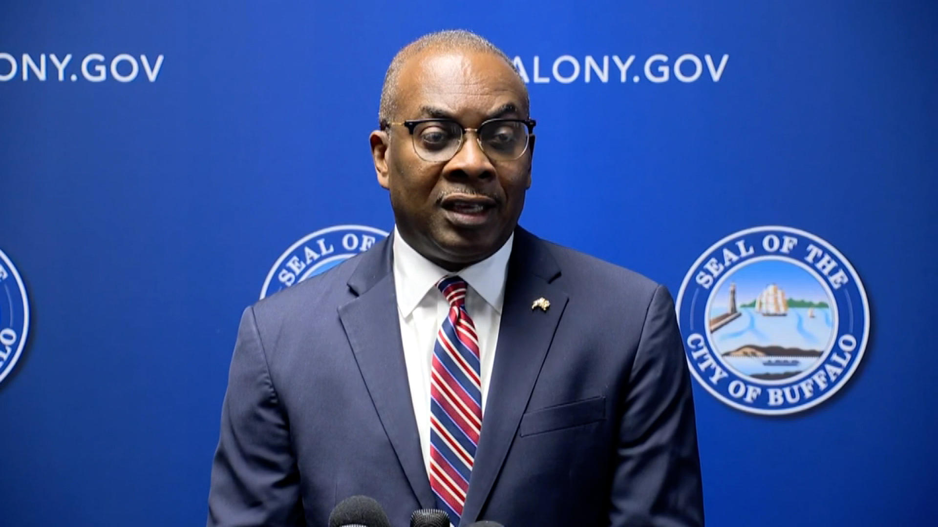
Buffalo mayor says city is preparing for the worst, but not expecting repeat of deadly 2022 storm
From CNN's Artemis Moshtaghian and Samantha Beech in New York.
Buffalo Mayor Byron Brown speaks to the media on Friday in Buffalo, New York. WKBW
The mayor of Buffalo, New York, says the area is prepared for this weekend's winter weather — and they're not expecting the type of storm the city dealt with in late 2022, when dozens died.
The forecast: The National Weather Service issued a winter storm warning for Buffalo and the surrounding area from 10 a.m. ET Saturday through to 3 p.m. ET Sunday.
The NWS said heavy lake-effect snow and very strong winds are expected. Blizzard conditions will be possible at times, especially late Saturday night and Sunday morning, according to the winter storm warning.
Preparations: Following the deadly 2022 storm, city leaders faced tough questions about their handling of storm preparations and the disaster response. Mayor Byron Brown said Buffalo is prepared for this new system. Its snow plan will be in full effect, and the city's emergency manager has met with different city departments.
"But we are asking members of the community to take the storm seriously," the mayor said, adding: "We are preparing for the worst, but hoping for the best."
3:37 p.m. ET, January 12, 2024
Illinois governor urges Texas Gov. Greg Abbott to stop migrant drop-offs during winter storm
“While action is pending at the federal level, I plead with you for mercy for the thousands of people who are powerless to speak for themselves,” Pritzker wrote. “Please, while winter is threatening vulnerable people’s lives, suspend your transports and do not send more people to our state.”
“Your callousness, sending buses and planes full of migrants in this weather, is now life-threatening to every one of the arrivals,” he said in the letter. “Hundreds of children’s and families’ health and survival are at risk due to your actions.”
CNN has reached out to Abbott’s office for comment.
2:19 p.m. ET, January 12, 2024
Centuries-old Maine landmark suffers serious damage from powerful storm
From CNN's Sarah Dewberry
Damage to the Pemaquid Point Lighthouse Park bell house is seen following a storm on Wednesday. Courtesy Bristol Parks and Recreation Department director Shelley Gallagher
Maine officials say an iconic state landmark dating back to the 19th century suffered significant damage after it was struck by high waves and winds during the powerful storm sweeping across the eastern half of the United States.
Only one wall of the Pemaquid Point Lighthouse Park bell house, built in 1897, is still standing after 79 mph winds struck it Wednesday, according to Bristol Parks and Recreation Department director Shelley Gallagher.
Gallagher said that — with another powerful storm on the horizon — time is essential to ensure more harm isn't done to the building. Officials have taken steps to shore up what remains of the structure, but are "very concerned" it isn't enough, Gallagher said.
The bell house was built to store a 1,000-pound bell that alerted sailors when fog set in and they couldn't see the lighthouse, according to Gallagher.
Luckily, the bell was not damaged in the storm — it was moved at the end of August because the beam on which it hung was rotting.
“The wall the bell was hanging on isn't there anymore, and a part of history would have been lost,” Gallagher said.
1:43 p.m. ET, January 12, 2024
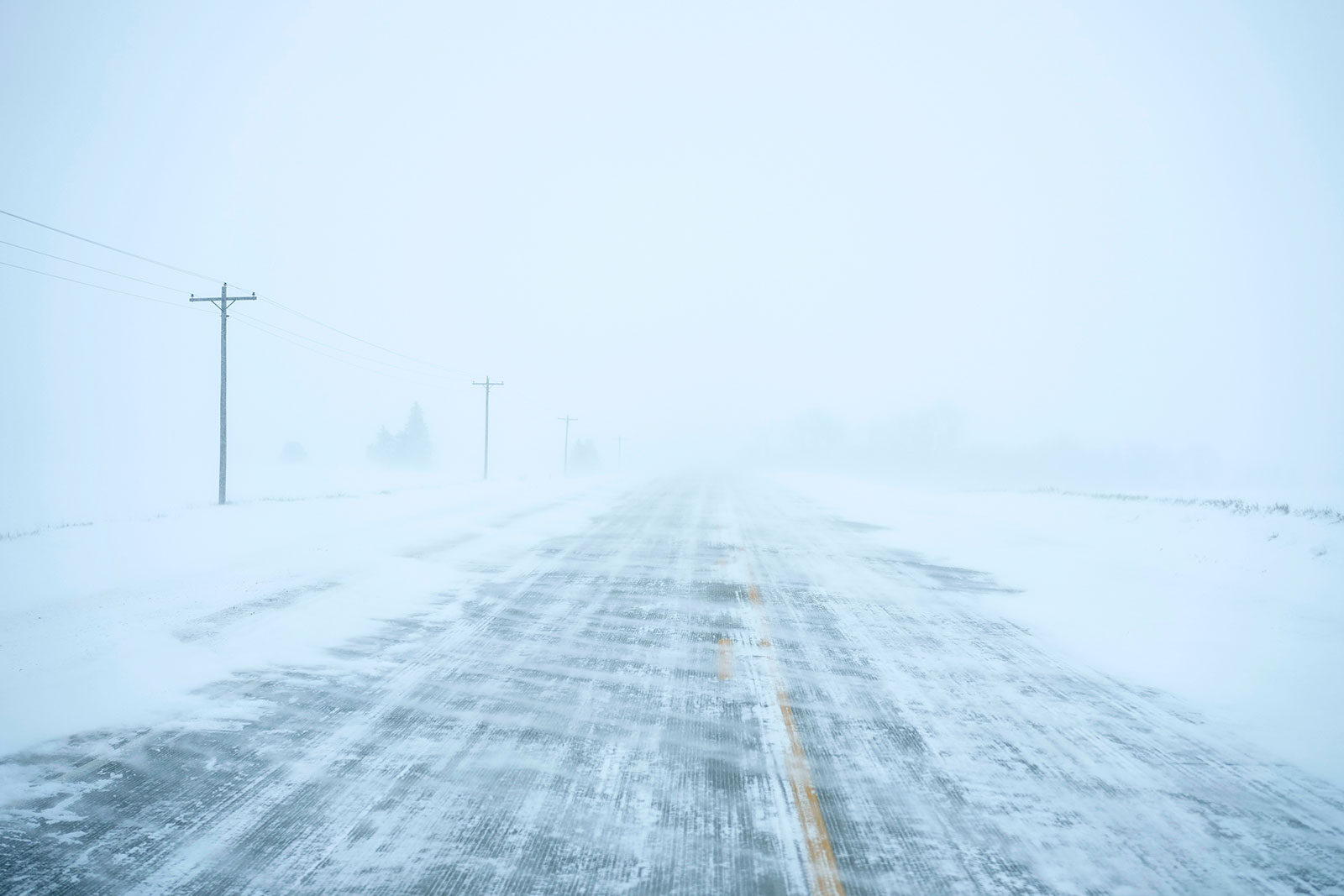
The storm is still strengthening. Here’s what to expect next
From CNN Meteorologist Mary Gilbert
Snow blows over a county road near Merrill, Iowa, on Friday Carolyn Kaster/AP
Heavy snow and blizzard conditions will continue to blast portions of the Midwest. Strong winds will also ramp up across the region, reaching their peak once the powerful storm hits its full strength Friday evening.
Thunderstorms will continue to roll across the Southeast, where some may become severe through Friday afternoon and evening. Rain and thunderstorms will arrive in parts of the mid-Atlantic by Friday evening and much of the Northeast will deal with rain and potential flooding by Friday night.
Here’s what a few cities in the path of the storm can expect:
Chicago: A mix of rain and snow Friday afternoon will gradually turn fully back over to snow Friday evening. Winds will remain gusty throughout the day, with gusts of 40 to 60 mph likely once again Friday night. Snow continues through Saturday as much colder conditions arrive.
Atlanta: Thunderstorms will continue to develop and move across the city Friday afternoon. Some may become severe, with the potential for damaging wind gusts, hail and even a tornado. A Level 2 out of 5 risk for severe thunderstorms is in place Friday with the potential for damaging wind gusts, hail and even a tornado. Storms will exit the area Friday evening, but breezy conditions will linger through Saturday.
Washington, DC: Rain and a few thunderstorms will arrive Friday evening and 1 to 2 inches of rain may drench some areas caught under heavy downpours. Winds will be quite strong with gusts of 30 to 50 mph possible. The combination of wind and rain may lead to power outages. Rain will taper off by early Saturday morning, but strong winds will persist.
New York City: Rain, heavy at times, and strong wind gusts of 40 to 60 mph will arrive Friday night. Rainfall amounts of 1 to 2 inches are likely across the city, with higher amounts possible just north. Rain will taper off Saturday morning, but gusty winds will persist through the weekend.
11:47 a.m. ET, January 12, 2024
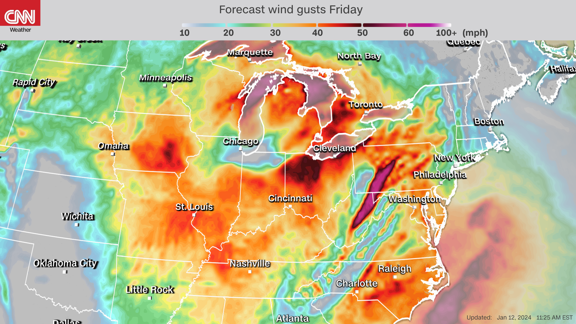
Over 150 million people face wind threats Friday. Here's what's behind the strong, prolonged winds
From CNN Meteorologist Mary Gilbert
Wind gust forecast for Friday evening. CNN Weather
Widespread wind gusts of 40 to 60 mph are likely across much of the Midwest and portions of the East as a powerful storm reaches its full strength Friday evening. Other portions of the central US will also get quite breezy Friday, with gusts of 30 to 40 mph possible.
More than 150 million people across the US are under wind alerts as roaring winds crank up in intensity. Multiple locations in northern Illinois — including the Chicago metro area — reported wind gusts exceeding 50 mph Friday morning.
Power outages also started to increase Friday morning, with Illinois and Wisconsin accounting for more than 100,000 outages.
What's driving the winds: Severe storms aren't driving these strong, prolonged winds — it's the impressive strength of the storm, which is an area of low pressure, and how it interacts with a strong area of high pressure located off the northeastern coast of the US.
The atmosphere is exerting pressure on all of us. The force of that pressure is lower under areas of low pressure and higher under areas of high pressure, hence the names.
As the storm gets stronger, its pressure drops and it creates a stronger gap in pressure between it and the high pressure, known as a pressure gradient.
The speed of the wind is related directly to the strength of the pressure gradient, because it squeezes the air that moves through it, forcing it to pick up speed. Think of it like popping bubble wrap: Once it’s squeezed hard enough, the plastic pops and the air quickly rushes out.
The strength, duration and widespread nature of winds Friday in this pressure gradient are likely to bring down trees and cause additional power outages.