
Editor’s Note: A version of this article originally appeared in the weekly weather newsletter, the CNN Weather Brief, which is released every Monday. You can sign up here to receive them every week and during significant storms.
Sunday marked the halfway point for meteorological winter (which runs from December 1 to February 28) and we have seen remarkable and unusual weather take place.
From the endless rainfall in the West to the unusually high number of tornadoes in the South to the lack of snow in parts of the Northeast (obviously not including Buffalo and nearby areas).
It’s safe to say, this winter has already been a grind, and people are weary.
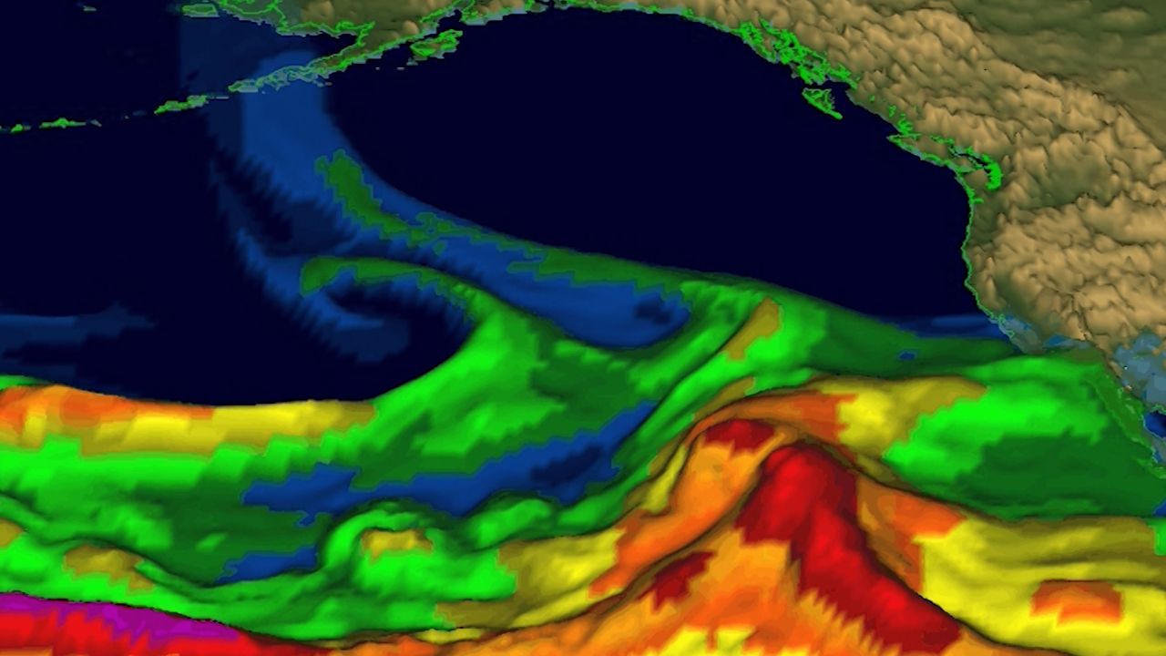
“The tornado events last week were directly linked to one of the stronger atmospheric river systems coming on shore a few days earlier in California,” Weather Prediction Center Branch Chief Greg Carbin said.
Like a ripple in the water, weather systems traverse the country, while constantly evolving.
The result can be the pattern we’ve seen lately, where the system comes onshore in the West with incredible amounts of rain and snow, and by the time it reaches the Southeast, it has manifested into a severe storm system.
“A lot depends on how the jet stream is established across North America with respect to how these systems track from west to east, and whether they maintain integrity and sufficient strength to produce a tornado outbreak, or whether they end up being a rainstorm or snowstorm,” Carbin explained.
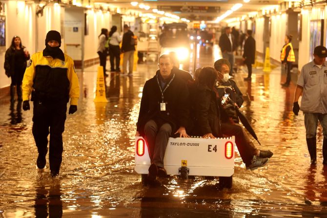
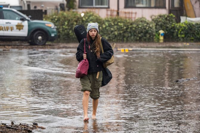
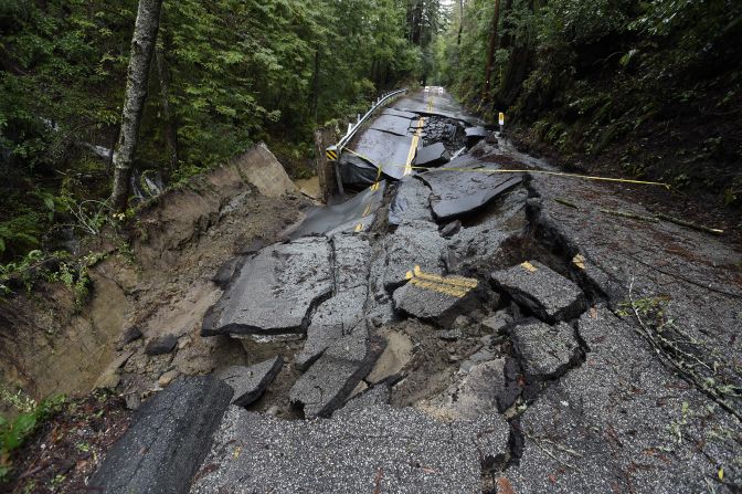
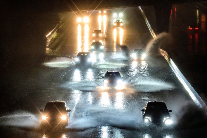
In the West, we’ve seen more than a foot and a half of rain fall across California since Christmas weekend, and more than 200 inches of snow.

The Sierra snowpack is nearly 250% of normal for California.
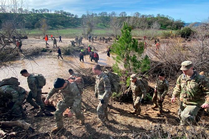
We have had more than 100 tornado reports this month alone across the US, which is four times more than the average number of tornadoes we would typically see for the first half of January.
There were more than 50 tornado reports on Thursday, in which at least nine people died.
The tornado that ripped through Selma was on the ground for at least 50 miles! In an area of the country known for spring tornadoes and a second season in the fall, now winter tornadoes are rearing their ugly head.
“It’s not as high right now as it could be in March or April, but the potential for severe weather always exists in that part of the country,” Carbin said.
In a typical year, Georgia and Alabama each average two tornadoes in the month of January.
This year, there have been 64 tornado reports in Georgia and Alabama.
In the Northeast, the lack of action has been the headline. From Washington DC to Boston, there has been below normal snowfall so far this season, leaving snow lovers bummed.
Central Park has only had a trace of snow so far this season, which is more than nine inches below normal.
Even at the higher elevations, which have had some snow, it’s still below average.
“Unfortunately, they had a big warm-up and rain in the wake of the heavy snow that fell up there around Christmas, so right now there’s a lot of parts in northern New England where the snowpack is just concrete,” Carbin said. “Every day that goes by is going to be harder and harder to make up any kind of normal. But you can’t rule out something happening here, at least for another month or so.”
Another link between the weather extremes is climate change.
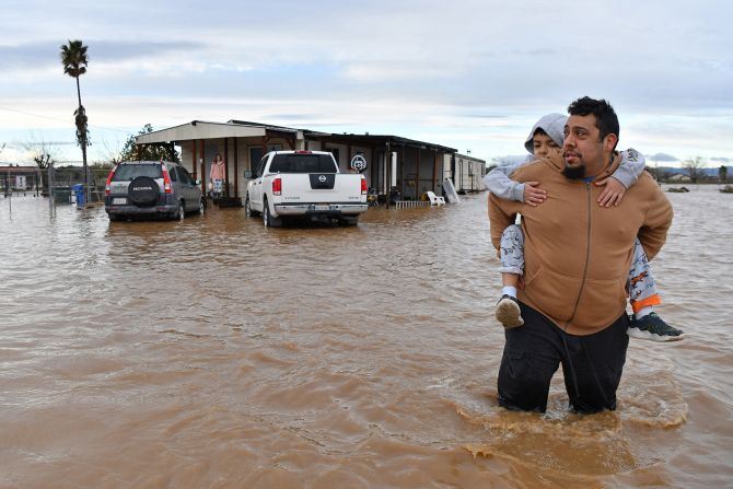
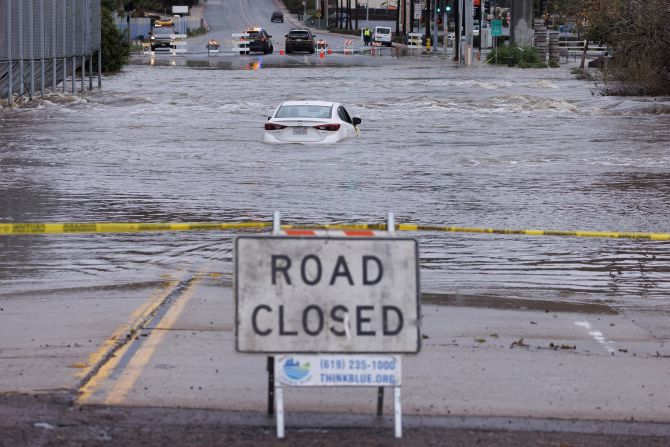
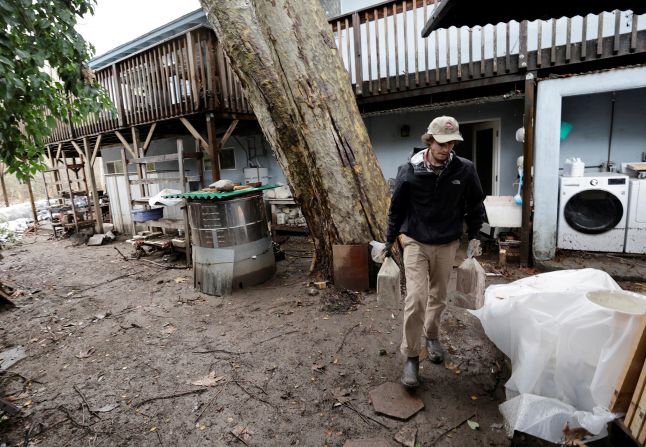
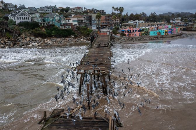
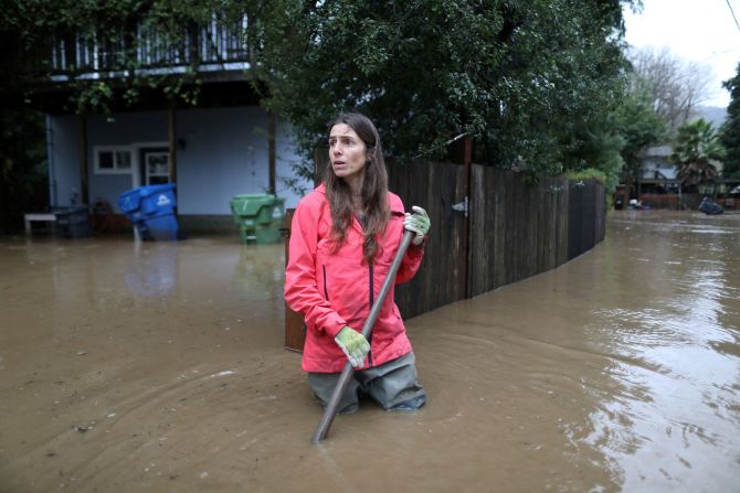

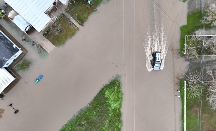


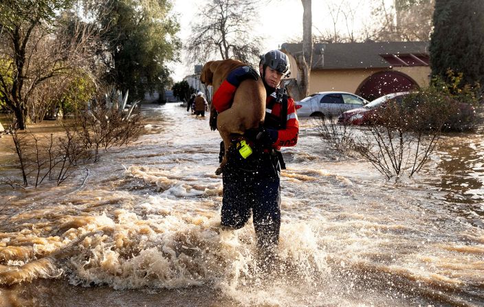

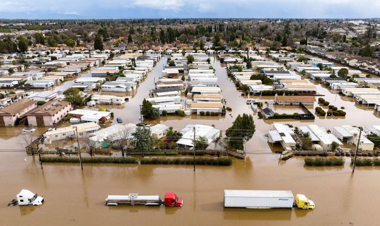

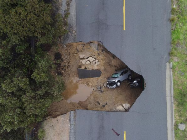

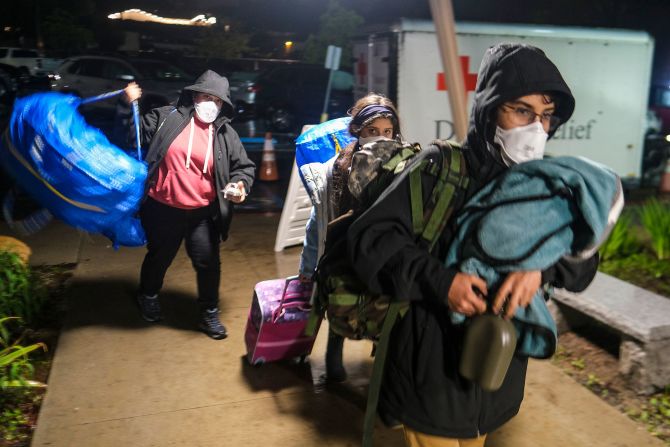

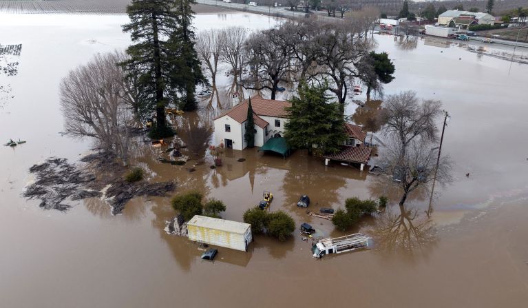
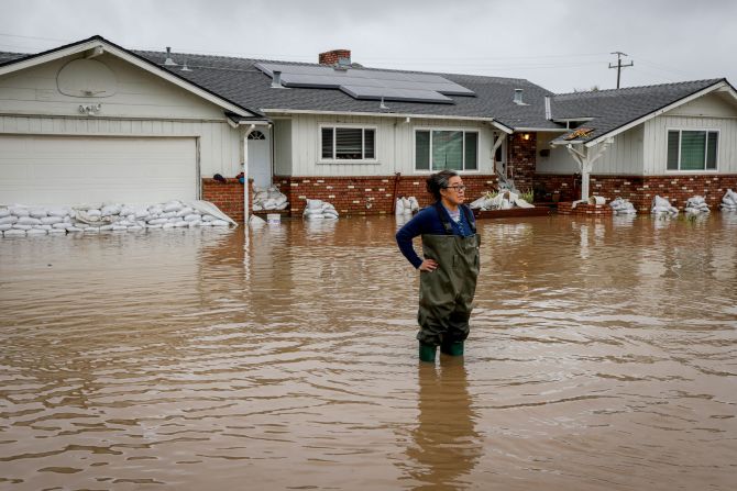


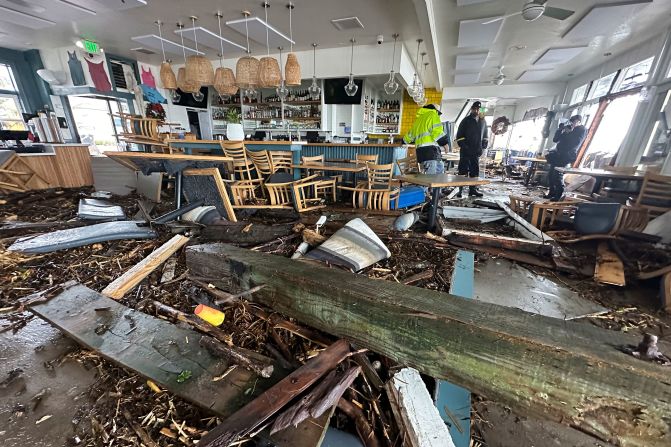
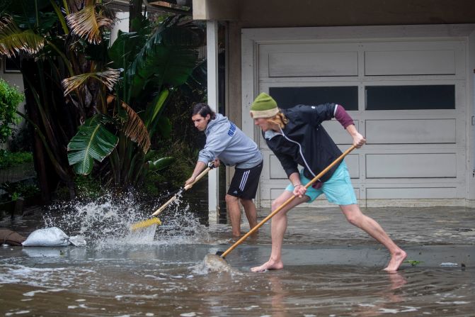
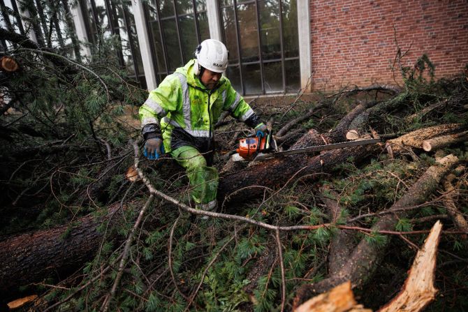
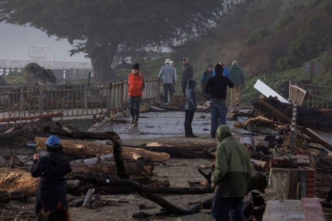


California's flooding, in pictures
“All weather, extreme and mundane alike, now occurs with this backdrop of warming ocean and atmospheric temperatures that we have compared to several decades ago,” CNN meteorologist and climate beat leader Brandon Miller said. “We are increasingly seeing symptoms of how this warming is influencing weather patterns.”
Atmospheric rivers are becoming wetter, which is something scientists have been warning about – alternating with hotter and drier periods leading to weather whiplash on the West Coast. And the tornado outbreaks are no different.
“More tornadoes occurring outside of traditional ‘tornado alley,’ clustering further east into more populated cities is another symptom of a warming climate that scientists have noted,” said Miller. “Tornado outbreaks in winter are expected to become more frequent as temperatures warm, and this winter has so far seen several.”
More rain and storms this week
There is another atmospheric river coming onshore along the west coast, which will potentially lead to another round of severe weather in the South by midweek.
The current system won’t be quite as robust as previous ones, but with the ground so saturated and rivers already flowing high, it won’t take much to see big effects.
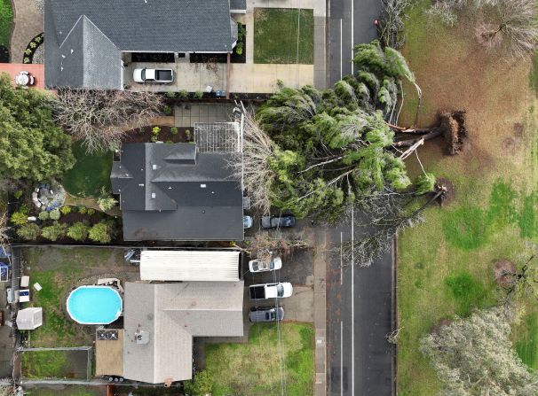
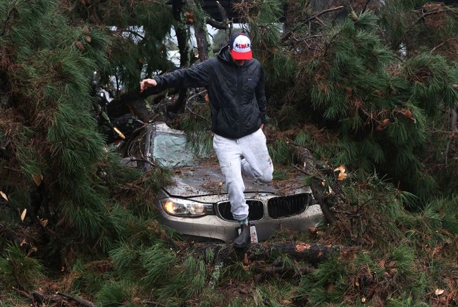
Heavy rain, gusty winds and the potential for rock slides and landslides will be something to look for throughout the day.
More power outages will also be a possibility.
“Total rain will range from a half inch to an inch with amounts up to 2.25 inches in the mountains,” the weather service in Los Angeles said.
They could see as much as half an inch of rain per hour, with even higher amounts within possible thunderstorms.

By midweek, the threat will be in the Deep South. The Storm Prediction Center has already highlighted an area from East Texas to the Lower Mississippi Valley for the potential for strong storms.
The area is currently under a Level 2 of 5 “slight” risk of severe weather, and includes Beaumont, Shreveport and Jackson.
“Robust wind fields should still support strong to severe thunderstorms along the front,” said the prediction center. “Primary risk with these storms will be damaging wind gusts.”
The system will be something to watch as it evolves over the next few days.
Stay up to date on the latest forecast here.
However, there is good news:
“This feature will be the final rainmaker for a while,” the weather service office in San Francisco said.

The news should come as huge sigh of relief across the West, as the pattern finally shifts after more than three weeks of steady, torrential rain.
While the western US has been piling up snowfall over the past several weeks, it has been the complete opposite across the Northeast and New England.
CNN meteorologist Monica Garrett contributed to this article.

