

Photos and satellite imagery from the central United States show how the region’s worst drought in at least a decade has pushed the Mississippi River and its tributaries to drop to record lows this month.
Across the river basin, dozens of gauges have fallen below their low-water threshold. The Mississippi River was at historically low levels from Illinois to Louisiana this week, and many of these gauges will continue to see decreasing water levels as the forecast remains stubbornly dry.
Video, photos and satellite imagery of the Mississippi River near Memphis shows how far the mighty river has contracted away from its banks.
The river dropped to minus-10.75 feet there earlier this week, according to data from the National Weather Service, which was the lowest level ever recorded in Memphis.
Drought expanded again this week across the Midwest and South, according to the US Drought Monitor. Half of the contiguous US is covered by moderate or worse drought conditions – the third-highest value of the year so far and the highest since March.
More than 134 million people are affected by drought conditions, the monitor reports, which is the highest percent population since 2016.
The Midwest has seen the worst deterioration, with the amount of area covered in drought increasing by an area of about 60,000 square miles, which is equivalent to the size of Georgia.
“Topsoil moisture continues to dry out across portions of the Ohio Valley and the Corn Belt,” the Drought Tracker reported on Thursday, adding that “deeper soil moisture remains very low also across much of the Mississippi Valley.”
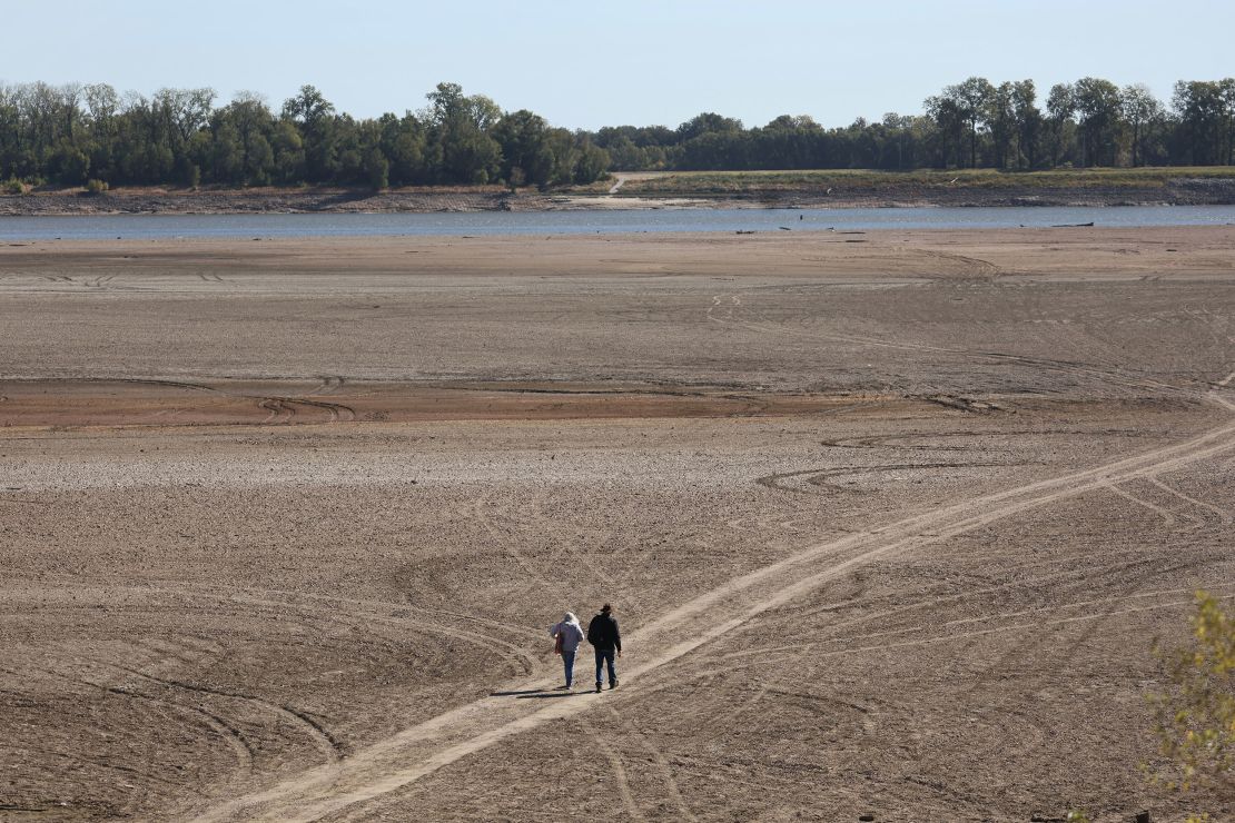
The dry conditions have taken a severe toll not only on the Mississippi but the rivers that flow into it.
Before-and-after satellite imagery from the National Weather Service shows how rivers have receded from their banks between July 14 and October 17.
The Mississippi River at the Kentucky Bend and New Madrid, Missouri:
The Ohio River at Mound City Landing, Illinois:
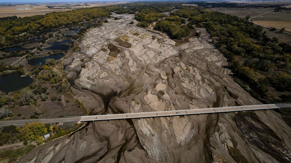
In Nebraska, aerial photos show the Platte River, which flows across the state and empties into the Mississippi, has almost completely dried up in some locations. The river has vanished near Kearney, Nebraska, and dry sand is all that’s left where water usually flows.
Several inches of rain are possible over the next week in the central US, according to the National Weather Service, which could provide some relief, particularly for the Mississippi River’s tributaries.
But the longterm outlook is drier than average. The seasonal drought outlook from the National Oceanic and Atmospheric Administration calls for the region’s drought to persist through January.
The river’s low levels have allowed people to walk on foot to Tower Rock, CNN has previously reported – an island in the middle of the Mississippi River south of St. Louis that is typically only accessible by boat.
The low levels are also allowing salt water from the Gulf of Mexico to creep up the Mississippi, and the Army Corps is now building a 1,500-foot-wide underwater levee to keep salt out of drinking water in Louisiana.
Additionally – just as the record-low water levels in Lake Mead have revealed several sets of human remains – a woman walking the banks of the Mississippi River over the weekend discovered bones that turned out to be human, officials said. The remains include a lower jawbone, rib bones and some unidentified bone pieces, Coahoma County, Mississippi, Chief Medical Examiner Scotty Meredith told CNN.
The Tennessee Valley Authority announced this week it would release more water from two dams to help supplement water levels on the Mississippi River. At Cairo, Illinois, the Mississippi “is approaching its lowest river level since 1901,” the agency noted on its Facebook page.
“To help stabilize commercial navigation conditions on the lower Ohio and Mississippi Rivers, we are scheduling special water releases from Kentucky Dam on the Tennessee River and Barkley Dam on the Cumberland River to help low river level impacts,” the agency wrote.
Travis Brickey, a spokesperson for TVA, tells CNN that water from the dams is typically released on a fluctuating basis, as they operate on a “generate-stop-generate-stop” cycle.
But for the foreseeable future, the dams are releasing a consistent flow of water to help counteract the impact the ongoing drought is having on water levels.
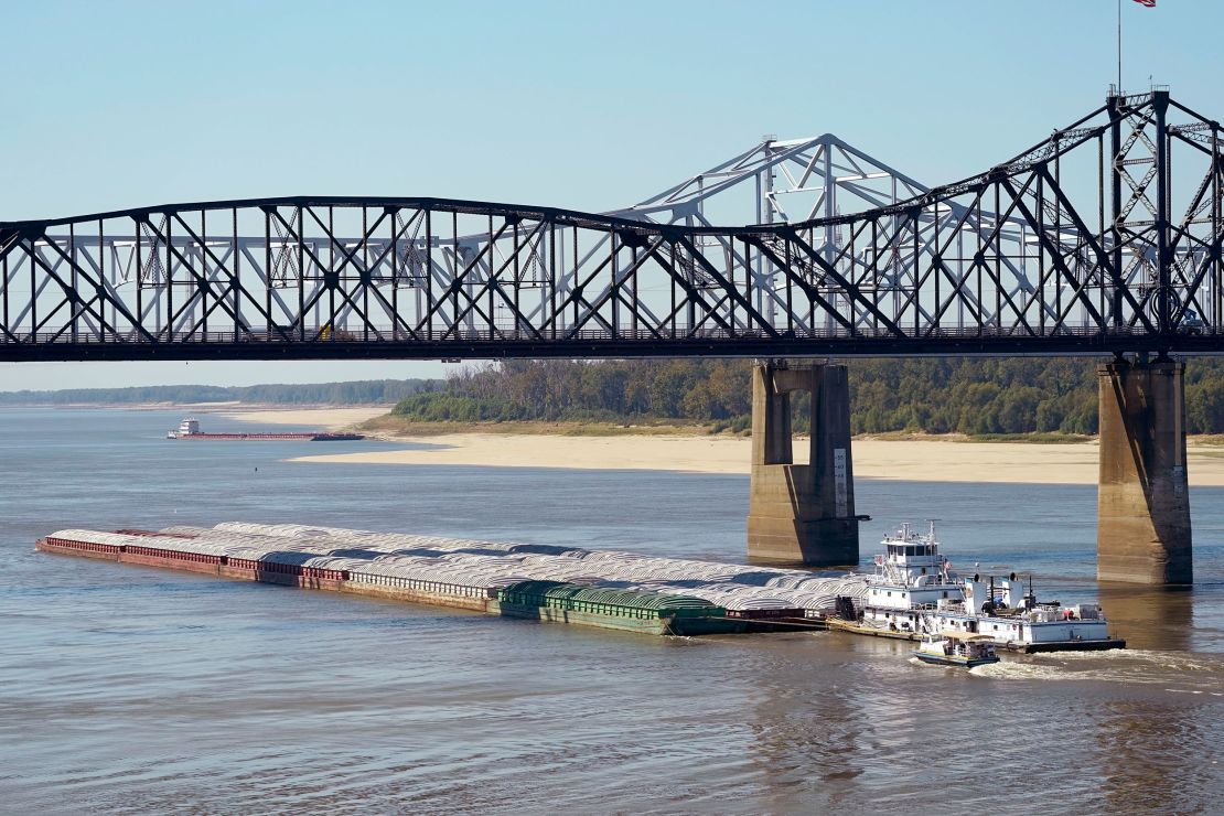
The low water levels on the Mississippi come at a crucial time of the year for the transport of crops from the nation’s heartland, CNN has previously reported.
The Army Corps of Engineers has been dredging portions of the river to keep traffic flowing, albeit at a much slower pace. Hundreds of barges and vessels have been queuing up this month, waiting for the all-clear to pass through the treacherously low river.
This story has been updated.
CNN’s Kevin France, David Williams, Andi Babineau, Rachel Ramirez and Chris Isidore contributed to this report.


