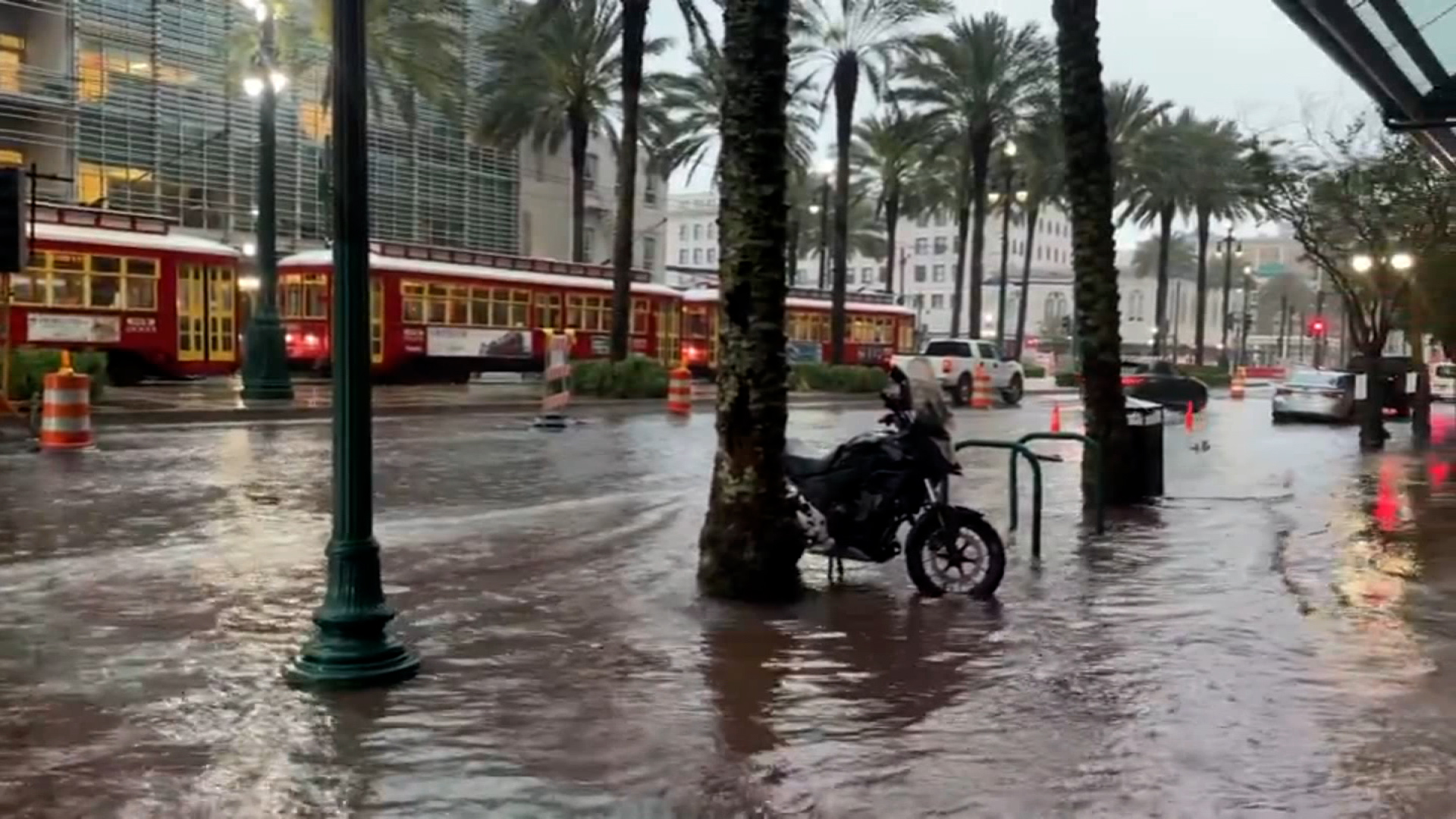
Floodwaters are seen on a street in New Orleans on Wednesday. courtesy David Nola
Torrential rainfall has triggered a flash flood emergency for the New Orleans metro and areas to the east until 3 p.m. ET (2 p.m. CT).
More than 400,000 people are at risk for life-threatening flash flooding, the National Weather Service warned.
"This is a particularly dangerous situation. Seek higher ground now!" the weather service office in New Orleans warned. "Emergency management reported numerous roads in and around New Orleans are underwater and impassible."
At least 3 inches of rain have already fallen across the city since the early morning hours. Gushing rainfall of up to 2 inches of rain per hour continues to fall across the area.
11:39 a.m. ET, April 10, 2024
Tornado in progress in southern Mississippi
From CNN Meteorologist Mary Gilbert
A damaging tornado is tracking through southern Mississippi as storms strengthen in the South.
"At 10:25 am CDT, a confirmed tornado was located near Stennis Space Center, or 10 miles west of Diamondhead, moving northeast at 40 mph," the National Weather Service warned.
11:23 a.m. ET, April 10, 2024
Hurricane-force wind gust reported in Louisiana
From CNN's Eric Zerkel
A line of powerful storms racing across Louisiana Wednesday morning produced wind gusts so strong that they were akin to the winds found in a Category 1 hurricane.
A wind gust of 83 mph was reported in Hackberry, in Cameron Parish, around 15 miles southwest of Lake Charles, Louisiana.
Category 1 hurricanes have winds of at least 74 mph, but those are sustained winds, and this report was just a singular, sudden burst of wind. Regardless, the storm was capable of significant damage.
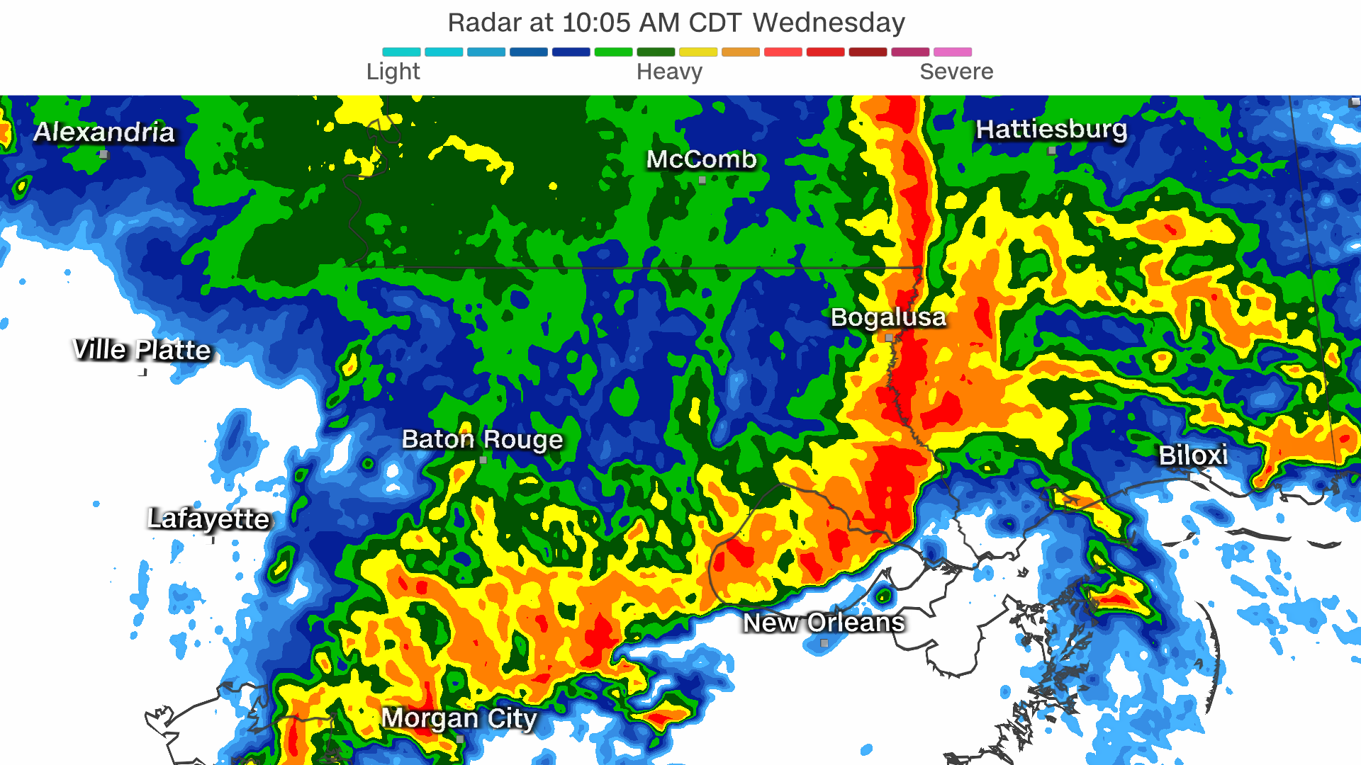
The dangerous storms prompted the National Weather Service in New Orleans to issue the highest possible severe thunderstorm warning on Wednesday morning, telling people in parts of Baton Rouge to prepare for "destructive ... hurricane-force" winds that could easily damage homes and knock out power.
A wind gust of 71 mph was reported in east New Orleans with several other gusts topping 60 mph across the state.
11:13 a.m. ET, April 10, 2024
Destructive storms approaching New Orleans
From CNN meteorologist Mary Gilbert
Ferocious and dangerous storms are pushing into the New Orleans metro area. These are "destructive storms" with hurricane-force winds, the National Weather Service in New Orleans warned.
"Mobile homes will be heavily damage. Expect considerable damage to roofs, windows, and vehicles," the service warned.
The line of storms is moving east at a very quick pace of 55 mph and will produce wind gusts up to 80 mph — equivalent to a Category 1 hurricane.
Torrential rainfall and hail are also likely within this line of storms.
CNN Weather
11:06 a.m. ET, April 10, 2024
Tornado watch issued in Alabama and the Florida Panhandle
From CNN's Eric Zerkel
A tornado watch has been issued by the Storm Prediction Center for more than 1.5 million people living in southern Alabama, including Mobile, and portions of the Florida Panhandle, including Pensacola, until 6 p.m. ET (5 p.m. CT).
Storms moving through the region in the coming hours will likely produce "a few tornadoes ... with a couple intense tornadoes possible," the storm center said. "Widespread damaging winds and isolated significant gusts to 80 mph [are] likely."
10:51 a.m. ET, April 10, 2024
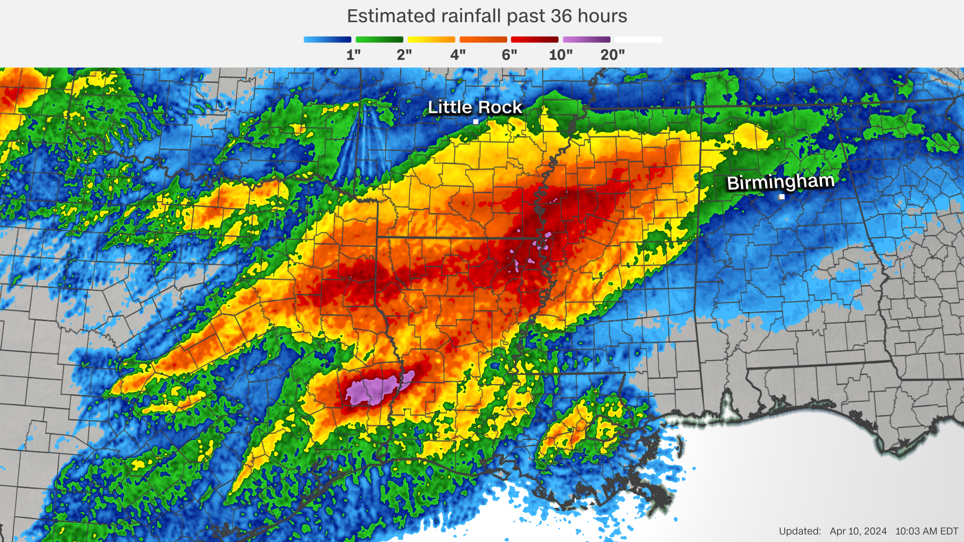
Flood emergency in Texas a sign of things to come
From CNN meteorologist Mary Gilbert
Wednesday's storms are unleashing an additional threat over the South: life-threatening flooding.
An estimated 12 inches of rain has fallen in parts of eastern Texas and western Louisiana over the last 36 hours, and storms capable of 2 to 3 inches of rain per hour will keep tracking through the region today.
Nearly 12,000 people in Kirbyville, Texas, and surrounding cities are under a flash flood emergency warning of life-threatening flooding until 12:30 p.m. ET (11:30 a.m CT). Torrential rain there caused rapid rises on area waterways, submerging local roads and forcing water rescues.
Flood alerts are in effect for over 13 million people from Texas to Georgia and Florida Wednesday as rounds of gushing storms move over the area. An additional 4 to 8 inches of rain could soak this area, where a Level 3 of 4 risk of excessive rainfall is in place, according to the Weather Prediction Center.
Deadly danger:Flash flooding is weather’s number-two killer, claiming more lives than anything but heat. It can happen when storms roll over the same areas for hours, with intense rain falling faster than the soil can absorb. Dangerous flash flooding turns roads into rivers and can wash out entire sections of seemingly solid ground.
Radar-estimated rainfall from Monday night to Wednesday morning.
10:46 a.m. ET, April 10, 2024
Severe weather damages more than a dozen homes across Mississippi
From CNN’s Rebekah Riess
Homes have been either damaged or destroyed in several counties across Mississippi after an initial round of severe thunderstorms pummeled the state Tuesday night, Gov. Tate Reeves said in an update Wednesday morning. No deaths have been reported.
Reeves said 12 homes were damaged in Hinds County, two were damaged in Neshoba County, one was destroyed in Warren County, and Yazoo County saw eight homes damaged and one destroyed. Additionally, downed trees have resulted in multiple road closures in Hinds and Yazoo County, according to the governor.
The governor said the state is in close contact with local emergency managers and is providing support "as necessary."
Reeves warned residents that the state is expected to experience more severe weather today.
"There’s a real possibility that the situation could get worse before it gets better," he said. "Please prepare in advance of today’s storms — it can be the difference between life and death and keeping your family safe."
10:23 a.m. ET, April 10, 2024
Tornado watch active for New Orleans and Jackson, Mississippi
From CNN's Eric Zerkel
A tornado watch from the Storm Prediction Center is in effect for nearly 4.5 million people living in southeastern Louisiana, including New Orleans, and portions of southern and central Mississippi, including Jackson, until 2 p.m. ET (1 p.m. CT).
Severe storms moving through this area have already produced wind gusts topping 60 mph and triggered multiple tornado warnings.
Additional storms moving through the region in the coming hours will likely produce "a few tornadoes ... with a couple intense tornadoes possible," the storm center said. "Widespread damaging winds and isolated significant gusts to 80 mph [are] likely."
10:56 a.m. ET, April 10, 2024
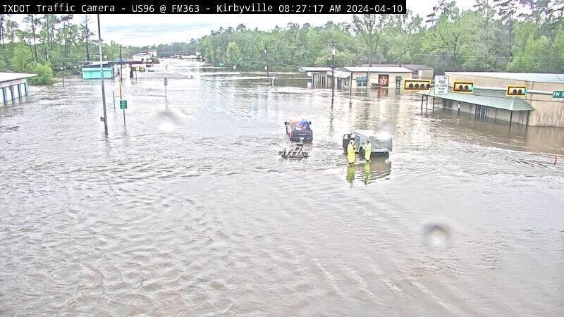
More than 400 people are assisting in rescues across Kirbyville, Texas, the fire department says
From CNN’s Andy Rose
A screengrab from a Texas Department of Transportation camera in Kirbyville shows a flooded roadway Wednesday morning after several water rescues were made in the area. from TXDOT
More than 400 people are helping with rescues in Kirbyville, Texas, following severe flooding Wednesday morning.
“Multiple fire departments, 409 boat rescuers, county, multiple agencies are working the Kirbyville area,” the Kirbyville Volunteer Fire Department said on Facebook.
“Some of the ‘rescues’ are senseless, people stuck in cars that shouldn't have been on the road,” the fire department added.
“People are driving around barricades and then finding out why the barricade was there in the first place.”
US Highway 96, Kirbyville’s only four-lane road, is closed to normal traffic, the fire department said, both because of the danger of driving through floodwaters and to prevent the wake of passing vehicles from causing more damage to buildings.