The atmospheric river will bring "one of the most dramatic weather days in recent memory" to LA

February 4 California storm updates

By Antoinette Radford, Zoe Sottile, Matt Meyer, Kathleen Magramo, Helen Regan and Deva Lee, CNN

Updated 5:57 a.m. ET, February 5, 2024
20 Posts
Sort byDropdown arrow
5:36 p.m. ET, February 4, 2024

The atmospheric river will bring "one of the most dramatic weather days in recent memory" to LA

From CNN Meteorologists Caitlin Kaiser & Elisa Raffa

The atmospheric river that is already dumping heavy rain across parts of northern and central California is set to bring "one of the most dramatic weather days in recent memory" to Los Angeles, according to the National Weather Service.

The rainfall forecast in Southern California continues to increase as the system begins to move into the area.

Downtown Los Angeles is forecast to see over 6 inches of rain through Tuesday, while surrounding areas can see anywhere from 5-10 inches.

Putting this in context: The average annual rainfall for Los Angeles is 12.23 inches, meaning that nearly half a year's worth of rain could fall in the next 48 hours. Combined with the 2.49 inches that fell in the city on February 1, Los Angeles could potentially receive almost a year's worth of rain in the first week of February alone. 

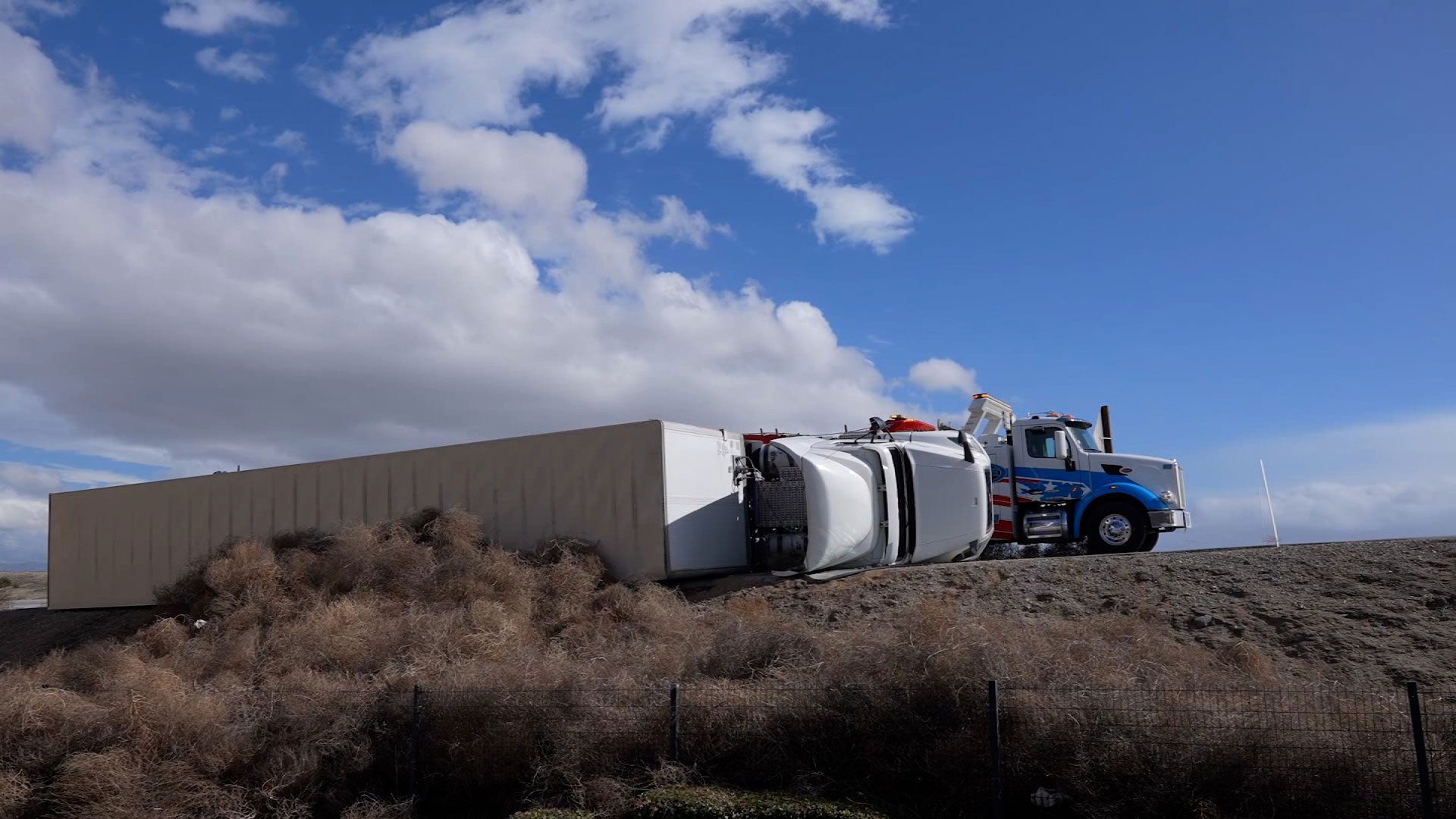
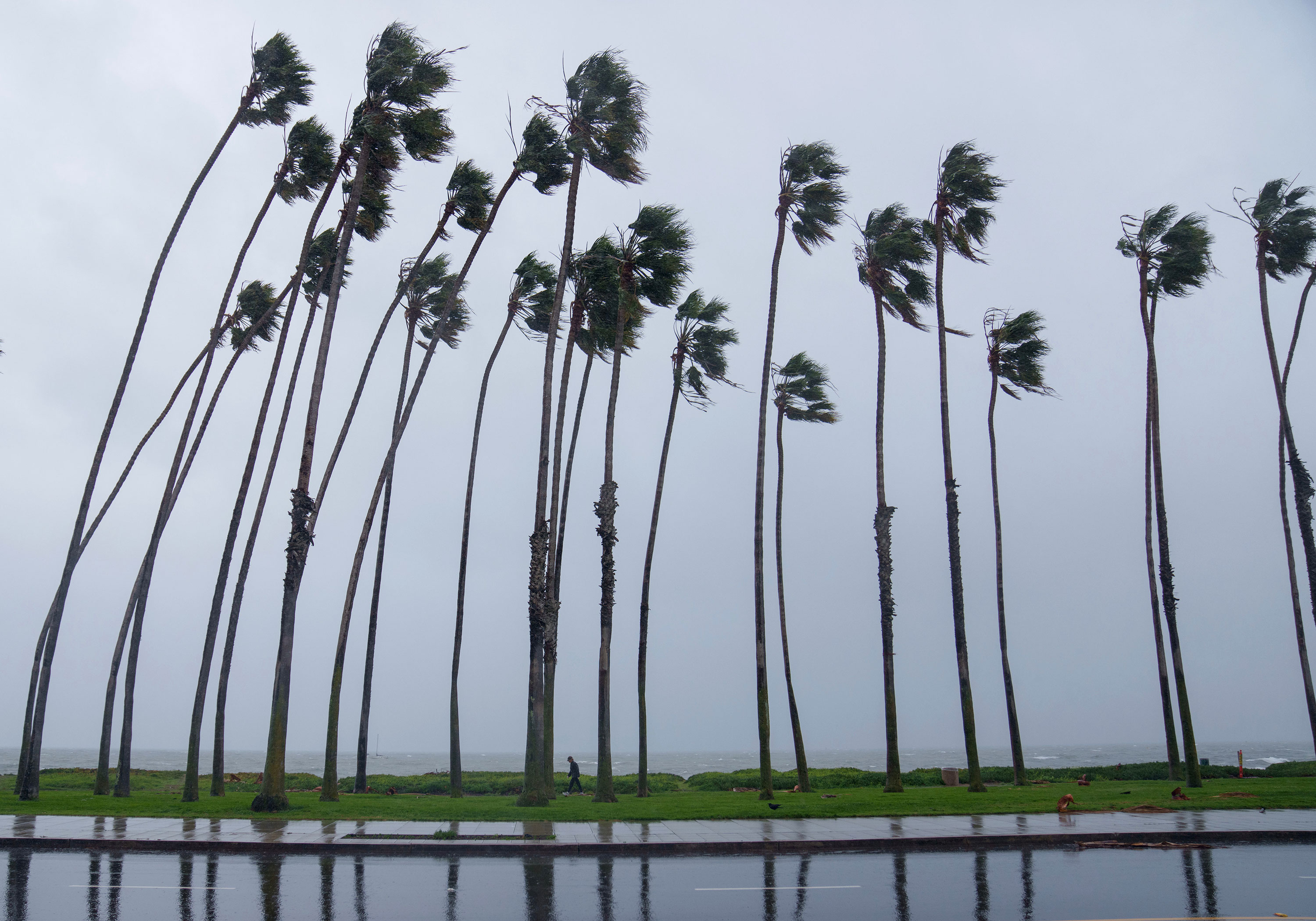
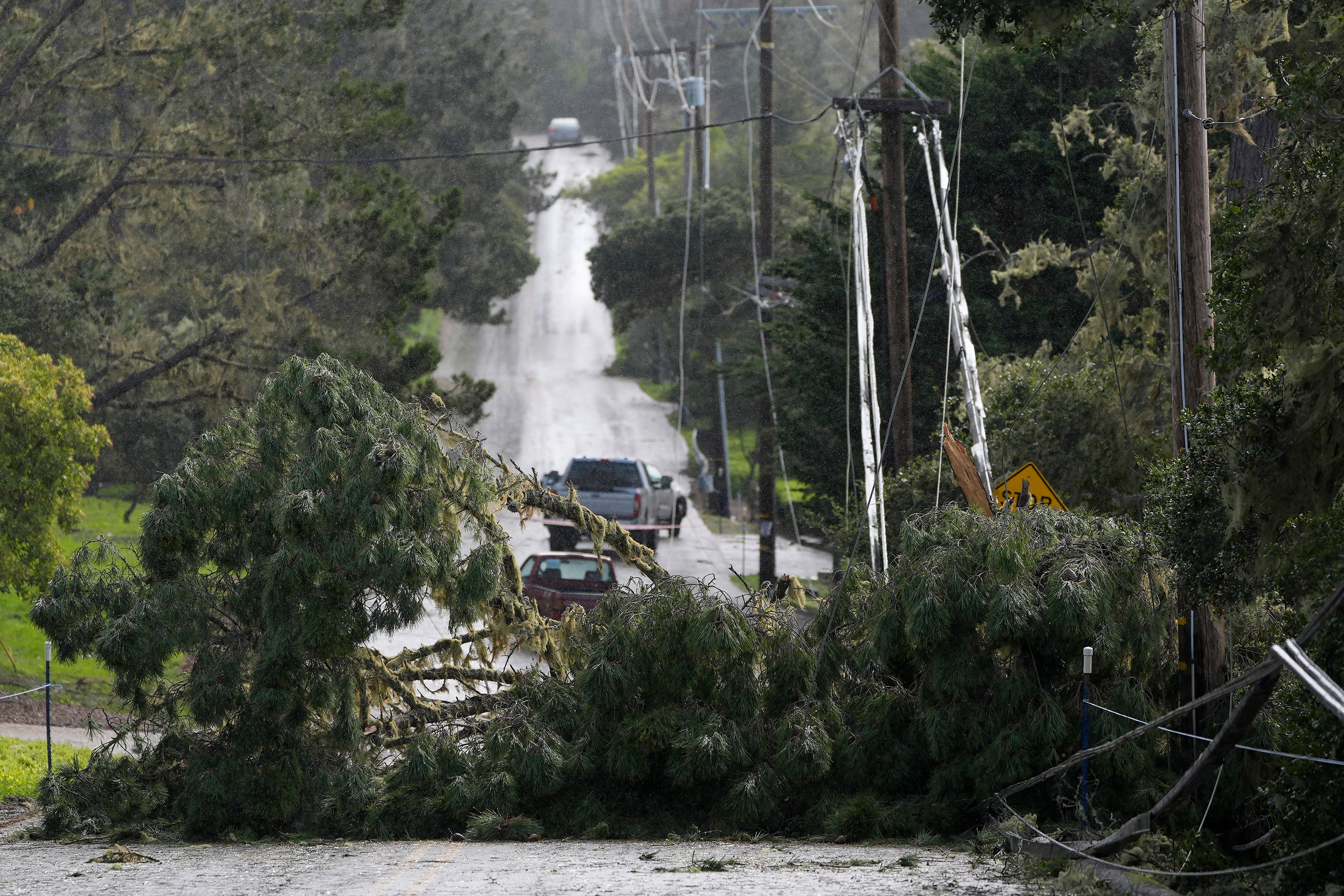
Other hazards: Landslides, flash flooding, falling trees, power outages and high waves are all concerns in areas experiencing high rainfall rates. Rising river levels will also contribute to flash flooding and pose a risk of drowning for anyone near the channel area. Some locations at higher altitudes will be impacted by heavy snow and "may be shut off for a day or two with heavy snow covering access roads," adds the weather service.

Local officials in Los Angeles are urging people living in affected areas to stay off the roads through at least Monday morning and to heed any evacuation orders.

5:48 p.m. ET, February 4, 2024

Semi-trailer tips over in strong winds in Grapevine, California

A still from a video shows a semi-truck that was blown over in Grapevine, California, on Sunday.
A still from a video shows a semi-truck that was blown over in Grapevine, California, on Sunday. Brandon Clement/LSM

Tumbleweeds rolled across the road, forcing cars to dodge them, and a semi-trailer was flipped in strong winds in Grapevine, California, on Sunday.

A video shows the trailer on its side, with a tow truck parked beside it. Later, the video shows large clouds of dust blowing across a road.

Grapevine is about 45 miles southeast of Bakersfield on Interstate 5 in Kern County. The highway through the area is a common trouble spot during inclement weather.

5:12 p.m. ET, February 4, 2024

The hazardous weather begins for Southern California on the night of the Grammy Awards

Celebrations on Sunday for the 66th Annual Grammy Awards could be complicated by the strong atmospheric river bringing potentially life-threatening flood conditions to the region.

The show begins at 5 p.m. local time (8 p.m. ET) and the red carpet event begins soon at Crypto.com Arena (formerly Staples Center) in Los Angeles.

5:13 p.m. ET, February 4, 2024

It’s just after 2 p.m. on the West Coast. Here’s the latest forecast for major cities

From CNN Meteorologist Caitlin Kaiser

Strong winds and heavy rainfall are setting in across the West Coast, leaving at least 200,000 people without power.

Evacuation orders have been issued for a small number of communities in Los Angeles and San Jose, along with parts of the counties of Santa Barbara and Ventura, due to possible flooding or landslides. Meanwhile, at least 100 flights have been canceled and 250 others delayed at San Francisco International Airport.

Here is a city-by-city forecast for the major areas impacted by the atmospheric river driving today's inclement weather:

Los Angeles

  • Peak rainfall: Begins now and lasts until 4 a.m. local time (7 a.m. ET) Wednesday
  • The greatest risk for life-threatening flash flooding is from late this evening through morning rush hour tomorrow
  • Rainfall total expected: 4-8 inches
  • Wind speeds: 20-25 mph, gusts of 25-35 mph

San Francisco

  • Peak rainfall: Begins now and lasts until 1 p.m. local time (4 p.m. ET) Monday
  • Showers will linger through Tuesday
  • Rainfall total expected: 2-3 inches
  • Wind speeds: 20-30 mph, gusts of 40-50 mph

Monterey

  • Peak rainfall: Begins now until 4 p.m. local time (7 p.m. ET) Tuesday
  • Showers will linger through Wednesday
  • Rainfall total expected: 2-3 inches
  • Wind speeds: 30-40 mph, gusts of 50-60 mph

Fresno

  • Peak rainfall: Begins now until 4 a.m. local time (7 a.m. ET) Wednesday
  • Rainfall total expected: 1.5-2 inches
  • Wind speeds: 20-25 mph, gusts of 30-40 mph

Sacramento

  • Peak rainfall: Begins now until 9 p.m. local time (6 p.m. ET) Monday
  • Rainfall total expected: 2-3 inches
  • Wind speeds: 30-40 mph, gusts of 45-55 mph

Las Vegas

  • Peak rainfall: Begins at 1 a.m. local time (4 a.m. ET) Monday until 10 p.m. local time Wednesday
  • Rainfall total expected: 1-1.5 inches
  • Wind speeds: 10-15 mph, gusts of 15-20 mph
5:13 p.m. ET, February 4, 2024

Over 200,000 California power customers lose service as wind gusts strengthen

From CNN's Caitlin Kaiser 

Wind blows palm trees during a storm in Santa Barbara, California, on Sunday.
Wind blows palm trees during a storm in Santa Barbara, California, on Sunday. Eric Thayer/Bloomberg/Getty Images

Power outages are rapidly rising in California, particularly along the coast, as rain and strong winds associated with the atmospheric river move into the area.

As of 1:25 p.m. local time (4:25 p.m. ET), over 200,000 customers are without power in California, according to PowerOutages.us. This is up from 60,000 customer outages just a few hours earlier.

Power outages are expected to continue to rise, especially in central and southern portions of California, as wind gusts grow stronger throughout the evening and into tomorrow.

Here are some of the notable wind gusts observed across the state so far:

  • Monterey: 85 mph
  • Santa Clara: 81 mph
  • Saint Lucia Mountains - Falcon Road: 80 mph
  • Santa Barbara Southwestern Coast: De La Concepcion: 78 mph
  • San Luis Obispo County Mountains - Mt. Lowe: 77 mph
  • Santa Barbara County Inland Central Coast - Purisima Hills: 75 mph
  • Santa Rosa Island: 74 mph
4:36 p.m. ET, February 4, 2024

California Gov. Gavin Newsom visits state Operations Center for weather update

From CNN’s Sonya Hamasaki

California Gov. Gavin Newsom visits the state's Operations Center in Mather, California, on Sunday.
California Gov. Gavin Newsom visits the state's Operations Center in Mather, California, on Sunday. From Office of the Governor of California/X

California Gov. Gavin Newsom visited the state's Operations Center in Mather, California, on Sunday to receive an update on the latest weather forecasts and the state's response efforts. 

"A record 8,500 state-coordinated, prepositioned emergency assets are ready to respond to potential flooding, landslides, travel impacts and 911 calls," according to a post on X from Newsom's office. 

Newsom's office announced on Friday that the state has 1,200 pieces of winter equipment available to remove snow and ice from roads, 21 swift water rescue team on standby, and California National Guard members ready to rapidly deploy if called upon. More than 7 million sandbags have been placed ahead of the storm, and the state is prepared to provide shelter and food for more than 37,000 people. 


4:34 p.m. ET, February 4, 2024

Long Beach is "ready to respond" to extreme weather, fire captain says

From CNN's Sarah Engel 

Long Beach Fire Capt. Jake Heflin says his department has a "robust response capability" for the extreme weather hitting Southern California.

"We deal with swells, we deal with high tides, we deal with these types of storms. We've had experience in the past with this," Heflin said in an interview with CNN Newsroom on Sunday.

Heflin said Long Beach, which is located in southern Los Angeles County, is expecting upwards of 6 inches of rain in the coming days. He encouraged citizens to stay away from fast-moving waters and flooded intersections.

Heflin said that the city is staging backup generators and portable pumps "where we experienced some challenges in the last storm," referring to the previous atmospheric river that lashed the state just a few days ago. 

3:31 p.m. ET, February 4, 2024

Extreme weather means "stay home and stay safe," Caltrans director says

From CNN's Sarah Engel 

Fallen trees and power lines block a road in Pebble Beach, California, on Sunday.
Fallen trees and power lines block a road in Pebble Beach, California, on Sunday. Ryan Sun/AP

The director of the California Department of Transportation (Caltrans) says the organization has 4,000 staff members and plenty of storm equipment at the ready across the state

Director Tony Tavares described the department's efforts as "all hands on deck." As some crews in Northern California monitor wildfire burn scar areas, others deal with the snow and ice in the mountains, and crews along the southern coast watch for heavy flooding. 

"We're telling all Californians in the path of this storm, if you don't need to be on the roadways, stay home and stay safe. That's the best place right now,” Tavares said.
3:20 p.m. ET, February 4, 2024

Evacuations ordered for parts of Los Angeles neighborhood where fire burned last year

From CNN’s Sonya Hamasaki

Evacuation orders are in place for portions of Topanga Canyon in Los Angeles due to possible mud or landslides, according to the Los Angeles County Sheriff's Department.

The order — which went into place Saturday evening and lasts through Tuesday evening at 6 p.m. local time (9 p.m. ET) — is in place for Santa Maria Road, north of Topanga Canyon Road.

The Owens brush fire burned about 50 acres in this area last July. 

A Red Cross shelter in neighboring Reseda is open for residents. 

A separate evacuation order is also in effect for some residents in the Shadow Hills community of Los Angeles' San Fernando Valley on Sunday.