Share


1 of 15
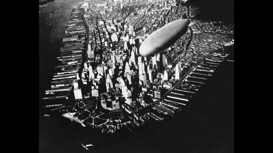
This aerial photograph from 1910 shows a Zeppelin dirigible flying over Manhattan. Aerial photography has existed since the mid-1800s, giving people a unique perspective of their planet. Roger Viollet/Getty Images
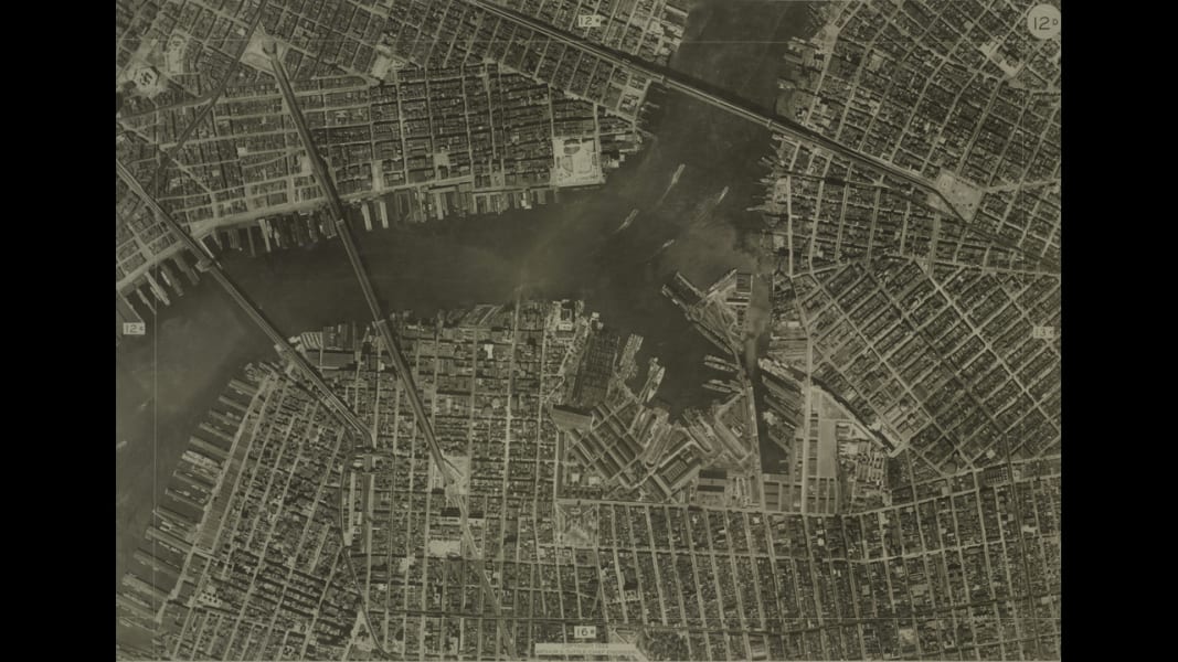
In the days before Google Maps, cities relied on aerial photos to help create street maps (back then they were on paper, kids). This aerial photo of New York was taken in 1924 by the city's Bureau of Engineering. The New York Public Library
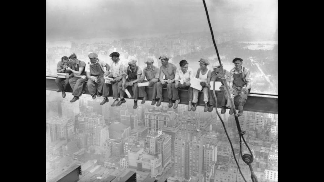
This unforgettable image, titled "Lunch atop a Skyscraper," was taken on September 20, 1932, during the construction of the RCA Building in New York. Bettmann/CORBIS
Life magazine photographer Margaret Bourke-White snapped this photo showing a DC-4 passenger plane flying over midtown Manhattan in 1939. Margaret Bourke-White//Time Life Pictures/Getty Images
Fog eclipses nearly all of midtown Manhattan except for the 103-story Empire State Building, seen in this 1961 aerial photo. New York Daily News via Getty Images
Back in 1971 when this photo was taken, New York's Twin Towers were the tallest buildings in the world. Chicago's Sears Tower was completed in May 1973. Henry Groskinsky/The LIFE Picture Collection/Getty Images
A purple haze enshrouds the city in 1989, with the Empire State Building in the foreground and the Twin Towers in the background. Hiroji Kubota/Magnum Photos
Four days after the September 11 attacks, this satellite image shows the remains of the World Trade Center buildings. Space Imaging/Getty Images
This aerial image taken in 2009 shows a cemetery in the Queens borough of New York City. Mario Tama/Getty Images
The lights on Broadway can be seen far above the city streets of midtown Manhattan. Antoine Rose/Barcroft Media/Landov
A blackout south of 39th Street in 2012. Superstorm Sandy cut power to millions in New York City. Iwan Baan/Getty Images
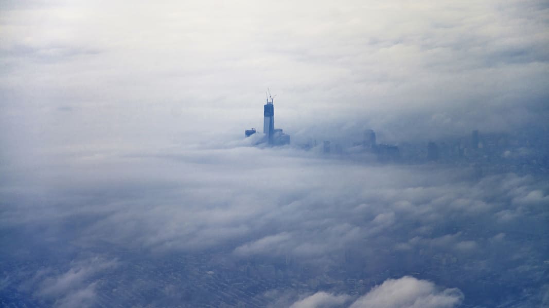
The newly constructed One World Trade Center building, dubbed "Freedom Tower," rises above the clouds on December 2, 2012, in an aerial photo taken from an airplane leaving New York's LaGuardia Airport. ERIC REICHBAUM/Reiters/LANDOV
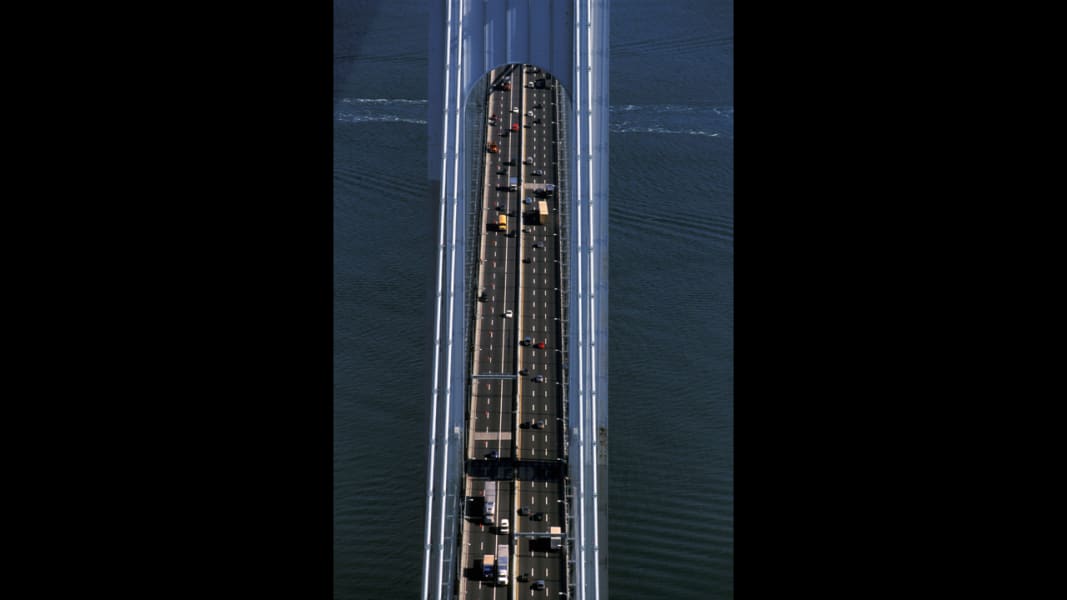
The double-decker Verrazano Bridge, as seen from above in this 2013 photo, connects the New York boroughs of Staten Island and Brooklyn. Guido Alberto Rossi/TIPS/ZUMAPRESS
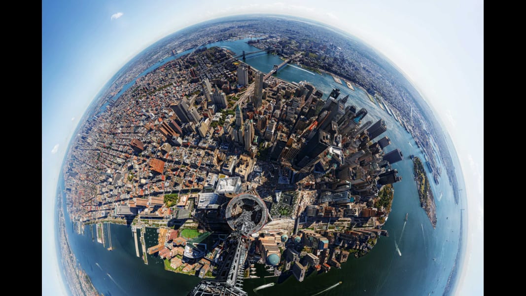
In 2013, Time magazine created this 360-degree panoramic view from the top of One World Trade Center, the tallest building in the Western hemisphere. Jonathan D. Woods and Michael Franz/Time
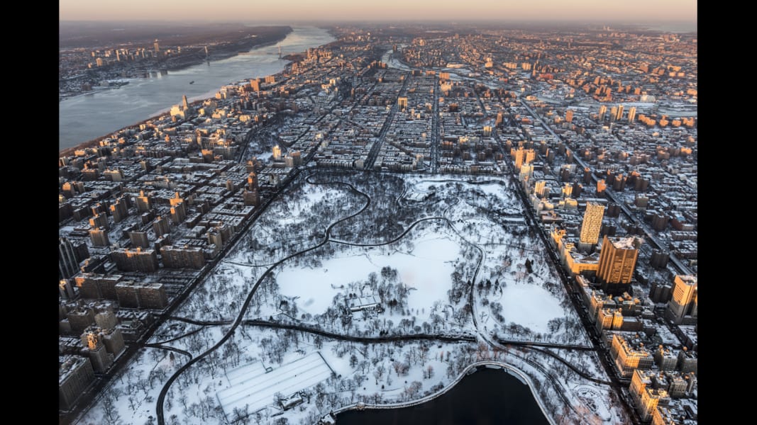
New York's Central Park is covered in snow in January. Nisian Hughes/Getty Images


