Need more proof it’s been a crazy summer for weather and travel? Look no further than Death Valley National Park.
The poster child of US parks for excessive heat and extreme aridity has had to close many of its roads yet again – not because of high temperatures or dust storms. Instead, water is the culprit.
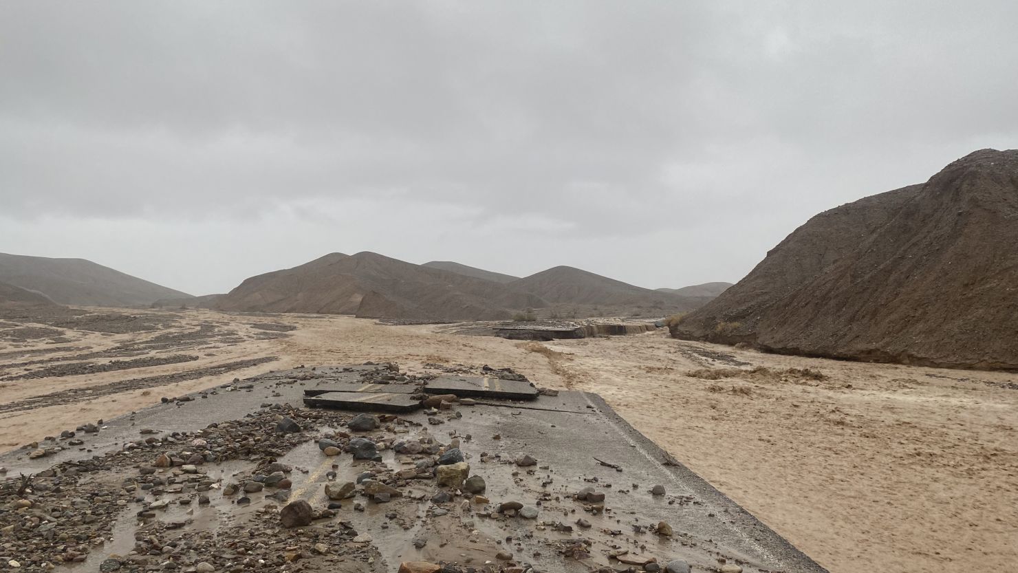
Another round of storms this week devastated roads in the Death Valley region, according to a news release from the US National Park Service. Multiple storms have torn through the park since late July, and many of the roads that reopened after record rainfall in August have been closed again.
“Road crews are exhausted from clearing, and then re-clearing, the same sections of roads,” the NPS release said.
“It’s been an exciting few weeks of rain, record-setting heat, and even a hurricane remnant!” Superintendent Mike Reynolds said. “There aren’t any more storms in the forecast. Hopefully we can make real progress getting more of the park open soon.”
What routes are closed?
As of Friday, the west entrance was closed because of extensive damage to California Highway 190 west of the park, which is set mostly in California with a small portion in neighboring Nevada.
This section of CA-190 had reopened for a few hours on Tuesday, the release said, but an evening storm caused “much more significant damage than the prior storm.”
Most paved roads into the park are closed. “The only route into the park is from the east, via Death Valley Junction and CA-190,” the release said.
As of Friday morning, it was still possible to drive to these features:
• Zabriskie Point
• Harmony Borax Works/Mustard Canyon
• Dantes View Road
• Mesquite Flat Sand Dunes
You can get a more detailed, current NPS report of what’s opened and closed by clicking here.
This week, the NPS road crew has been “concentrating on Badwater Road. … Sections of the road have debris up to three feet thick. Shoulders have eroded away leaving unsafe drop-offs. The Park anticipates opening the road from CA-190 to Badwater Basin by September 24,” the release said.
Why so much flooding?
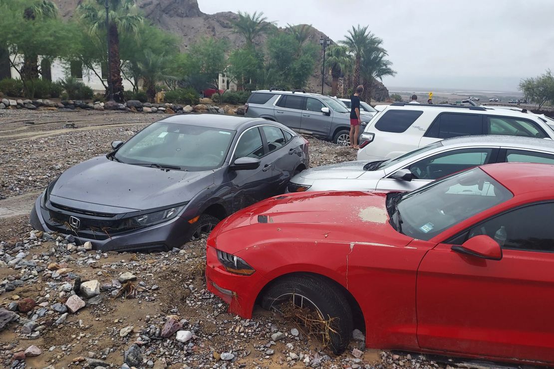
August 5 was a really bad day for flooding at the park when the Furnace Creek weather station recorded 1.7 inches of rain.
Some people might be surprised that less than 2 inches of rain can cause headlines; after all, places along the Gulf Coast can soak up that much rain in a day with little notice. But in arid regions, that much rain can trigger significant flooding.
The park received three-quarters of its 2.20-inch annual average rainfall in a few hours that day last month. That deluge stranded hundreds of people and closed the entire park.
CNN Weather’s seven-day forecast for the park has nothing but sunny skies and high temperatures, ranging from 92 degrees Fahrenheit (33 degrees Celsius) to up to 102 F (39 C).

